Tropical lows expand this week, high pressure & showers in NZ for now…
11/01/2026 10:46pm
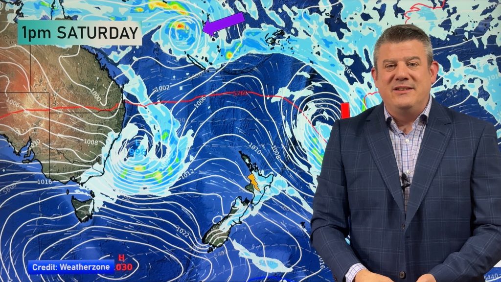
High pressure looks to be pretty dominant in the NZ area this week, but we have plenty of showers, downpours and a few inland thunderstorms in the mix too as humidity levels lift a little and more east to north-east winds develop.
There are at least four low pressure zones to monitor this week, three of them having tropical or subtropical connections.
A tropical cyclone near New Caledonia is possible later this week or weekend. It’s not locked in yet, with so many other lows in the region sometimes they can “steal energy” off each other, making for large lazy lows rather than one particularly aggressive one. Still, they are all worth monitoring as all these lows, even if offshore, may influence NZ’s weather. But higher air pressure looks to be the main driving force of our weather this week.
We have your forecast through until this coming Sunday.
Comments
Latest Video

Westerlies continue, sub-tropical for some
West to north-west winds blow through the South Island and lower North Island today bring heavy West Coast rain and…
Related Articles
Westerlies continue, sub-tropical for some
West to north-west winds blow through the South Island and lower North Island today bring heavy West Coast rain and…

Westerly change this week, unsettled but large dry areas
Westerlies kick back in again this week which will bring a break to those in the east as far as…

Matariki, the long weekend + the outlook for next week
Wet weather and cloud continues along the eastern side of the country with the heaviest rain now moving into northern…


Matt Needham on 12/01/2026 1:23am
Good afternoon love your video got my daughter‘s wedding coming up on this Saturday up in Tauranga what do you reckon it’s gonna be like Saturday afternoon Saturday evening kind regards Matt
WW Forecast Team on 12/01/2026 6:16am
Hi Matt, Saturday looks like it will have showers developing, possibly heavy with thunderstorms in the afternoon and early evening. But this far out we can’t tell if those showers will be in Tauranga, or form further inland. At this stage a mostly dry day overall.
Cheers and all the best!
– WW
Edit: Looking even drier for Saturday now 🙂
Huia on 11/01/2026 11:29pm
Is it inland for gisborne city for thunderstorms on Thursday and Friday
WW Forecast Team on 12/01/2026 1:25am
Hi Huia, in Gisborne city it’s possible thunderstorms may form inland and drift into the city, or may form over the city itself. It’s a bit hard to know this far out, as we’re talking about a specific cloud that will be forming days in advance, so for now we just know the general risk areas (ie, north-eastern North Island). Sometimes it’s not even known until the day itself where those specific cloud/cloud build-ups will form, due to sea-breezes and other airflows that can shift them around a bit on the map. Keep an eye on our Lightning Maps & MetService outlooks in the days ahead.
– WW