Subtropical low, windy for some, then high pressure slowly returns
10/03/2026 10:58pm
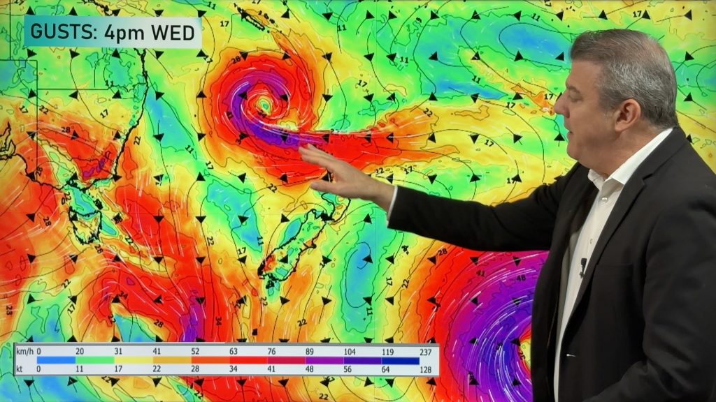
It’s cloudy and windy for parts of New Zealand today with the North Island especially gloomy under cloud associated with a subtropical low. High pressure is east of NZ so between the strong high and the fairly strong low we have a ‘squash zone’ of windy easterlies in the top of the North Island for the next day or two.
As far as rain is concerned, it’s a bit borderline for some in the upper North Island with the low falling apart as it moves closer on Thursday. We show you the rain and wind gust maps for this.
In the South Island a cold front is approaching, and by Friday PM and Saturday a south to south-west flow will spread up NZ, easing the humidity for northerners, but bringing a windy day to some exposed parts of the country. Those winds ease further going into Sunday and Monday.
Next week high pressure returns to NZ, but a tropical cyclone may be forming around New Caledonia.
Latest Video

Polar airflows set to bring cold weekend to NZ
Nor-west winds will be building over parts of NZ going into Thursday with rain on the West Coast becoming heavy…
Related Articles

NZ: Cold & windy, then calm & frosty
Downpours, some squally with the chance of thunderstorms and even small tornadoes are possible for parts of NZ over Friday…

WeatherWatch App launches real-time local lightning tracker
A bolt out of the blue! WeatherWatch has launched a live, real-time lightning tracker, enabling Kiwis to gain access to data provided by the…

Wind, rain, showers & a noticeable temperature drop for all
It will be a colder weekend right across NZ as a sub-Antarctic southerly blows through, bringing frosts, snow flurries and…

