WeatherWatch App launches real-time local lightning tracker!
5/07/2026 7:30pm

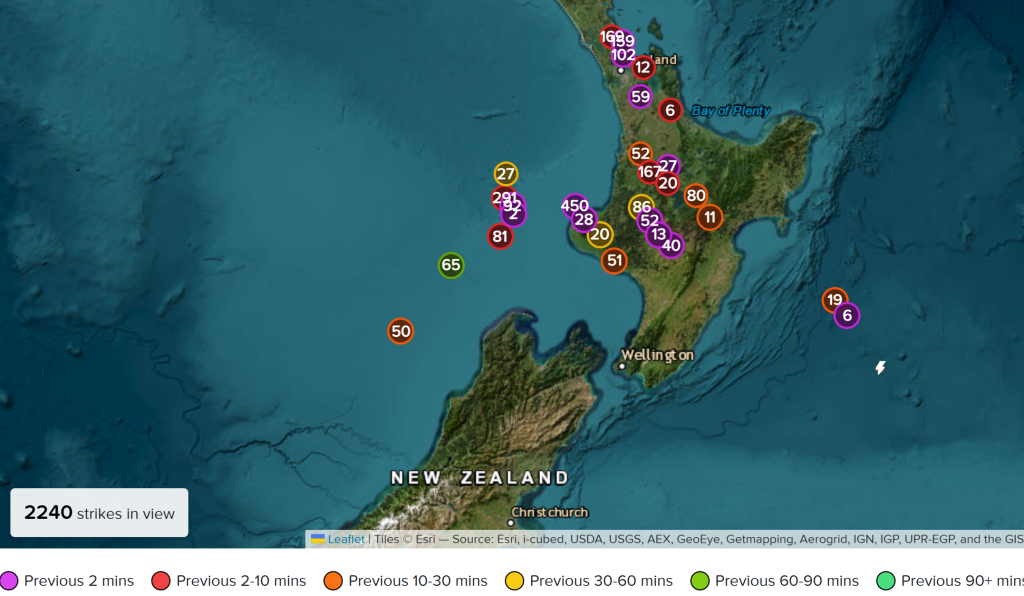
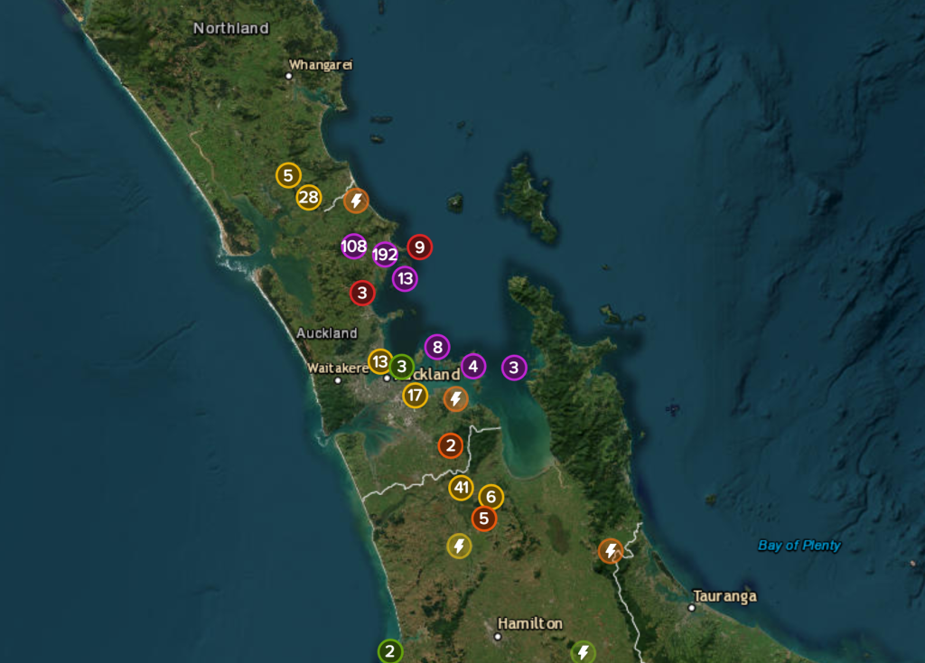
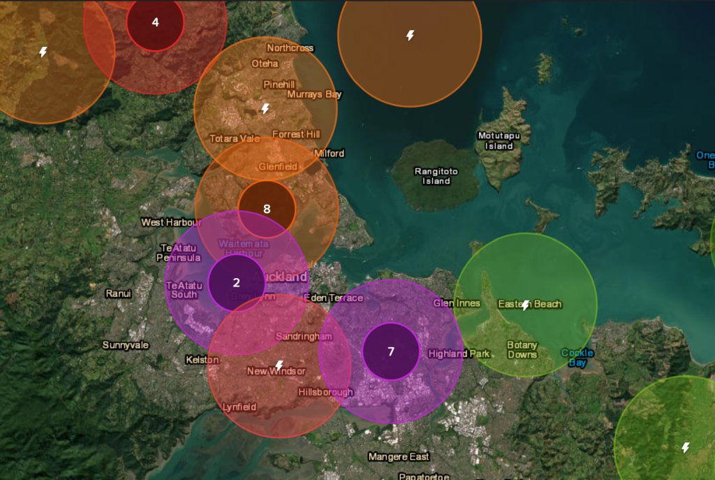
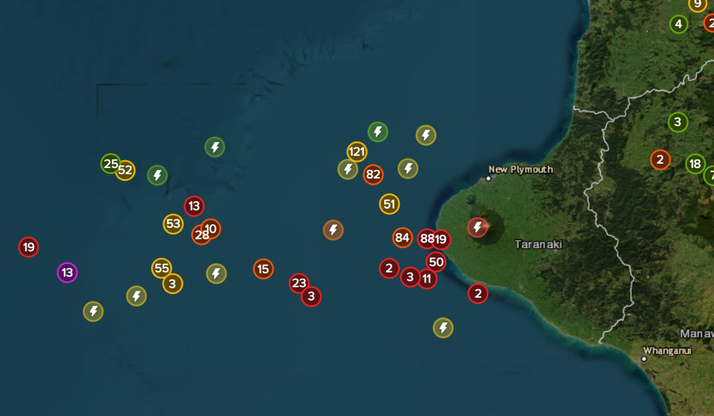
A bolt out of the blue! WeatherWatch has launched a live, real-time lightning tracker, enabling Kiwis to gain access to data provided by the most accurate and comprehensive lightning detection system in New Zealand.
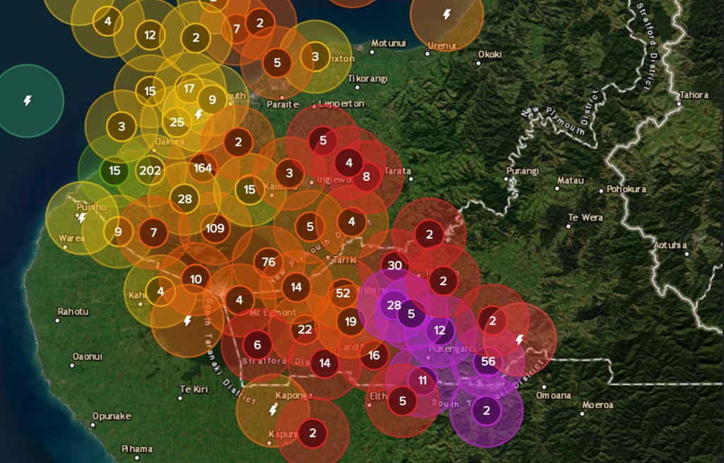
The new Real Time Lightning Tracker is powered by MetService data, sourced from Transpower’s national lightning detection network of 10 lightning sensors across the country. Unlike other systems that rely on overseas sensors, this network has been purpose-built for NZ, maximising detection accuracy across the country, and enabling the capture of many local lightning strikes that international networks don’t see.
It can be viewed for free (slightly delayed version) here on our website, but customisable push notifications/alerts and the real-time lightning map is via subscription upgrade in our app.
The alerting service will display lightning detected by the network to within 2 kilometres of your selected location(s) in New Zealand, and in many cases to within 500 metres. You can upgrade to receive push notifications to alert you of it in our App.
The Network has a detection efficiency of more than 95% and is able to detect both cloud-to-ground and cloud-to-cloud lightning – all pushed to your device in real time by WeatherWatch to make you aware of it. These are not forecast alerts – they are alerts of actual lightning that has just been detected. These capabilities make it more accurate and reliable than any other lightning tracker currently available in New Zealand, including those operated by large overseas organisations.
The live lightning tracker is now available via the WeatherWatch App with both paid real time personalised alerting and real-time maps, or, free delayed maps (by 15 minutes), giving New Zealanders instant access to critical information during thunderstorms. The free maps also use data that previously wasn’t publicly accessible. Those that sign up for LIGHTNING PLUS or PRO in our app (under “My Alerts“) will have access to the real time lightning map and set-up alerts.
This new service is particularly valuable for farmers, growers, tradies, boaties, golfers, gardeners, and corporate businesses, as well as anyone whose safety, operations, property or livelihood can be affected by lightning and severe weather.
“This is the first New Zealand made lightning tracker using official data. By combining WeatherWatch innovation and MetService data from the national lightning network, we’re helping New Zealanders gain access to the most accurate lightning information live, in real time” says WeatherWatch.
“The WeatherWatch App compliments information provided by MetService’s Severe Thunderstorm Watches and Warnings”
WeatherWatch innovation, along with MetService’s extensive quality data is a winner for all New Zealanders.
The launch represents a major step forward in helping New Zealanders make faster, safer decisions during thunderstorms, whether on the land, at sea, at work, or at home. WeatherWatch has invested all profits made from our current PRO Alerting App to fund the development of this – thank you for your ongoing support!
- Want more info? Check out our App Page with all the details on our latest update and compare plans. You can also view the FREE delayed maps via our website here or within the “Maps” tab in the Basic/Free plan in our app.
How it looks:
Latest Video

Wintry weather coming: Snow, rain, wind & sunshine
A cold front is moving into NZ from Friday to Sunday with low pressure developing west of NZ and then…
Related Articles

Polar airflow + northern low = pockets of heavy rain & snow
A colder change is coming – and so too is a large low which will develop and grow over northern…
Wintry weather coming: Snow, rain, wind & sunshine
A cold front is moving into NZ from Friday to Sunday with low pressure developing west of NZ and then…

ClimateWatch: JULY outlook & what El Niño means for NZ
El Niño is officially here and still getting stronger in the months ahead, but it’s harder to notice its effects…

