ClimateWatch for December & rest of Summer (Jan/Feb) +13 Maps & 15min Video
2/12/2020 4:00am

> From the WeatherWatch archives
La Nina is a no show for the start of December in New Zealand with an aggressive spring-like westerly returning. Why? Because the Southern Ocean is stormier than usual and La Nina is only moderately strong.
In fact La Nina is likely to peak in December and January before easing into 2021. As WeatherWatch.co.nz has been exclusively saying for months now, this moderate strength La Nina, which is measured at the equator, may not have the impact news outlets and Government forecasters are headlining.
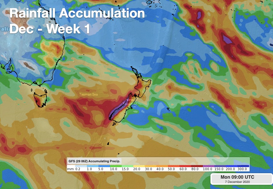
Instead, the first two weeks of December will be heavily dominated by strong westerlies, Southern Ocean storms and western rain. Northern NZ will be closer to high pressure – with a powerful belt of high pressure between NZ and the tropics basically stopping La Nina weather patterns in our part of the world.
But it doesn’t last this way.
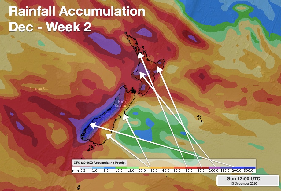
By mid-December there are some signs of sub-tropical and tropical life and possibly a sub-tropical low bringing in rain to northern NZ.
Long range the data from IBM does suggest wetter weather will come in to northern NZ over December and January.
Temperatures – generally speaking – look to be at least 1 degree above normal for December and January and maybe 0.5 to 1 degree above normal for February.
Our next ClimateWatch VIDEO update will be issued at the end of January but we will have a ClimateWatch NEWS update on December 31 at WeatherWatch.co.nz and www.RuralWeather.co.nz.
THE MAPS:


FORECAST RAINFALL….

Red = Drier than usual, White = Normal rainfall, Blue – Wetter than usual.
THE AIR PRESSURE SET UP…Tracking the highs and lows into most of December…


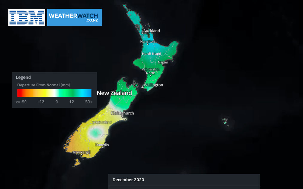
LONG RANGE FOR ALL OF SUMMER (DEC, JAN, FEB)


ACCURACY
The accuracy in the three maps above from IBM/WW are is about 65%. This is the most accurate long range data for NZ, but it’s not perfect.
It’s a helpful guide to roughly see if rain may be returning or not. While La Nina isn’t overly powerful for NZ this year the warmer sea surface temperatures are with us. Once high pressure from northern NZ and north of NZ finally breaks up and clears there is a significantly increased chance of sub-tropical lows and rainmakers developing.
NEXT CLIMATE DRIVER UPDATES
– Our next ClimateWatch Video will be issued in two months time, in late January
– Our next ClimateWatch News update will be issued, with full maps, on December 31
Comments
Latest Video

NZ: 8 Day outlook as gales & rain ease, high pressure builds
Damaging wind gusts and heavy rain will continue to affect some parts of the North Island and brushing Marlborough today…
Related Articles
NZ: 8 Day outlook as gales & rain ease, high pressure builds
Damaging wind gusts and heavy rain will continue to affect some parts of the North Island and brushing Marlborough today…

Pockets of hit & miss heavy rain, snow moves northwards
Low pressure continues to slowly move across the upper North Island and for some that will bring the sun out,…

Slow go for northern low & southern cold
For the next few days low pressure will crawl over the upper North Island, driving in rain as far south…


Anna Ta on 4/12/2020 6:27am
Helpful forecast, thanks. Much appreciated.
It is surprising to see you surprised that summer will be one degree warmer than average – isn’t this consistent with models of anthropogenic climate change?
The “climate” forecast is extremely helpful, thanks for all your work
WW Forecast Team on 4/12/2020 6:11pm
Thanks for the comment and kind feedback :). We’re surprised because it doesn’t just automatically apply to the whole country each and every month (the extra 1 degree). NZ’s location on earth means we get some good injections of cooler air too which can somewhat regulate our temperatures. But yes, you’re right – probably should be so surprised really.
Cheers
Phil D
Bryan Norton on 1/12/2020 5:38pm
Thanks for the useful maps & insights.
WW Forecast Team on 1/12/2020 6:30pm
Cheers Bryan, thanks for the kind feedback.
Phil D
Peter Thomas Langer on 1/12/2020 4:01am
yeah well if it was a real la nina the places below taupo would be in danger of drought