Weekend low “one to monitor” as high pressure slips away for a time
9/02/2026 10:43pm
We have a gap in the high pressure belt, starting Friday and possibly lingering until the start of next week. Long range maps have been picking a low with some severe weather potential for nearly two weeks now for mid-February, but it’s still not clear yet if the severe weather will affect land or remain offshore.
The low may be in a position this weekend to rapidly deepen and become a storm east of the North Island. We’ll still need a few more days to be certain of this – so either way keep up to date with the forecasts this week as we head into the weekend.
Behind this low pressure may be yet another strong anticyclone (high presssure belt) – so we’re not done with the summer weather yet.
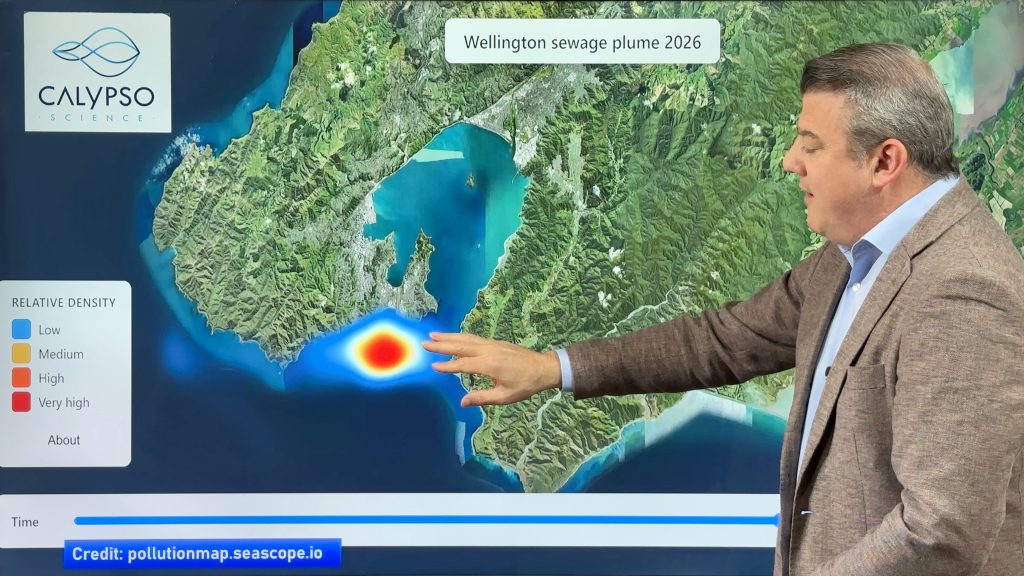
We also promote the Calypso Science sea pollution map to track the sewage dump in Wellington at the moment: https://pollutionmap.seascope.io
Comments
Latest Video

NZ: 8 Day outlook as gales & rain ease, high pressure builds
Damaging wind gusts and heavy rain will continue to affect some parts of the North Island and brushing Marlborough today…
Related Articles
NZ: 8 Day outlook as gales & rain ease, high pressure builds
Damaging wind gusts and heavy rain will continue to affect some parts of the North Island and brushing Marlborough today…

Pockets of hit & miss heavy rain, snow moves northwards
Low pressure continues to slowly move across the upper North Island and for some that will bring the sun out,…

Slow go for northern low & southern cold
For the next few days low pressure will crawl over the upper North Island, driving in rain as far south…


Wayne on 10/02/2026 1:50am
Thanks again for an honest weekly weather forecast Phil.