Stormy low may bring severe weather Sunday/Monday to North Island
10/02/2026 10:20pm
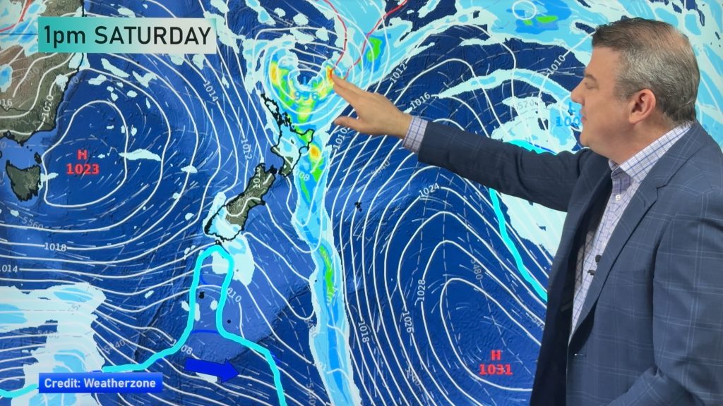
Low pressure is expected to deepen quickly this weekend near the upper North Island and track just east of the island going into Monday, with the potential for severe weather over the eastern and north-eastern sides of the island. As we discuss in the video, there are a few moving parts for this to all lock into place and there is a chance this low may mostly miss NZ, but other modelling shows both wind and heavy rain may still clip the north-eastern corner of the North Island in particular. We show you the latest tracking and expect to be able to confirm things more by Friday.
Elsewhere we have showers and large dry areas as one large high moves away and the next one tries to move in next week – and it’s between these two highs that this stormy low may develop.
We also have two 7 day rainfall maps to show the “wiggle room” for the potential heavy rain that is currently forecast.
Latest Video

NZ: 8 Day outlook as gales & rain ease, high pressure builds
Damaging wind gusts and heavy rain will continue to affect some parts of the North Island and brushing Marlborough today…
Related Articles
NZ: 8 Day outlook as gales & rain ease, high pressure builds
Damaging wind gusts and heavy rain will continue to affect some parts of the North Island and brushing Marlborough today…

Pockets of hit & miss heavy rain, snow moves northwards
Low pressure continues to slowly move across the upper North Island and for some that will bring the sun out,…

Slow go for northern low & southern cold
For the next few days low pressure will crawl over the upper North Island, driving in rain as far south…

