ClimateWatch: MARCH is looking quite orderly to start with
2/03/2026 1:30am
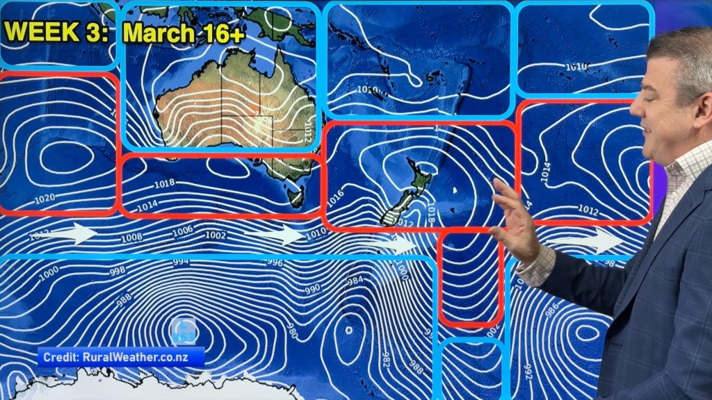
Storms near Antarctica, Autumn’s westerlies building south of Australia & NZ, high pressure again affecting both nations and the tropics has low pressure – those are the layers of weather over the coming weeks which, for the most part, are sticking to their lanes. Of course March is the peak of the tropical cyclone season, so any tropical storm can break a long range outlook, but for the most part we’re seeing drier weather in southern Australia and large parts of NZ, while the tropics get more active – especially around Australia.
We track the highs and lows on the way, the status of La Nina (continues to weaken and should be gone soon) and the chances of El Nino forming later this year.
We also look back over the past month to track soil moisture levels in NZ and Australia, and sea surface temperatures right around Australasia and the south-west Pacific.
ClimateWatch videos are a monthly outlook tracking the weather patterns and climate drivers.
Latest Video

Polar airflows set to bring cold weekend to NZ
Nor-west winds will be building over parts of NZ going into Thursday with rain on the West Coast becoming heavy…
Related Articles

NZ: Cold & windy, then calm & frosty
Downpours, some squally with the chance of thunderstorms and even small tornadoes are possible for parts of NZ over Friday…

WeatherWatch App launches real-time local lightning tracker
A bolt out of the blue! WeatherWatch has launched a live, real-time lightning tracker, enabling Kiwis to gain access to data provided by the…

Wind, rain, showers & a noticeable temperature drop for all
It will be a colder weekend right across NZ as a sub-Antarctic southerly blows through, bringing frosts, snow flurries and…

