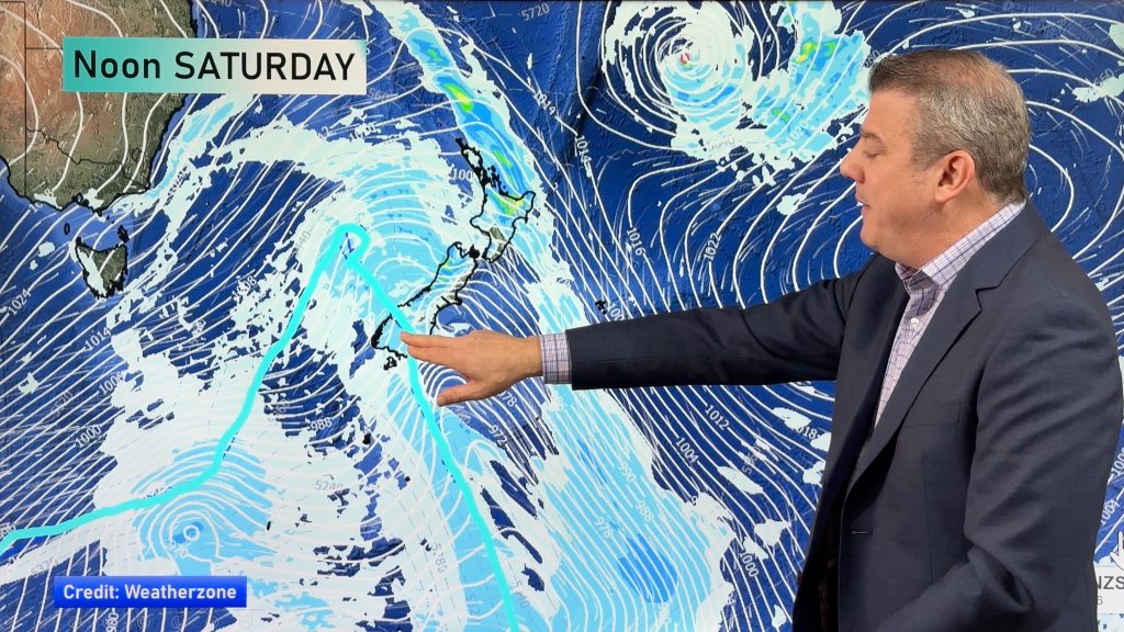
Uesi Update: Warmer Tasman Sea adds fuel to Cyclone Uesi (+Animation of storm reaching NZ)
13/02/2020 12:26am

> From the WeatherWatch archives
Cyclone Uesi today moves into the Tasman Sea area and on Friday will lie between New Zealand and Australia. On Sunday it moves into the South Island of NZ with heavy rain on the West Coast and some spillover to the east.
Latest estimates show this low won’t be as intense as the recent deluge that caused serious flooding and slips around Fiordland, Southland, Otago and Westland. However 125 to 150mm is currently forecast on the western side which will add more pressure to some areas to still recovering. The good news is that spillover into Southland and Otago looks manageable at this stage.
Monday looks to be windiest but damaging winds look limited with hurricane force winds mainly at sea and not over land based on latest modelling. This may change so keep up to date with any Government funded warnings at MetService and of course our latest news, video and map updates at WeatherWatch.co.nz.
WeatherWatch.co.nz says Uesi will track down over the central Tasman Sea where sea surface temperatures are currently 1 or 2 degrees above normal, which will help Uesi maintain more energy as it moves in to the South Island.


SEA SURFACE TEMPERATURES SHOW MUCH OF THE TASMAN SEA WARMER THAN AVERAGE, HELPING FUEL UESI:
– WeatherWatch.co.nz
Comments
Before you add a new comment, take note this story was published on 13 Feb 2020.


Add new comment