Rain and wind, then a temperature drop
5/05/2026 11:58pm
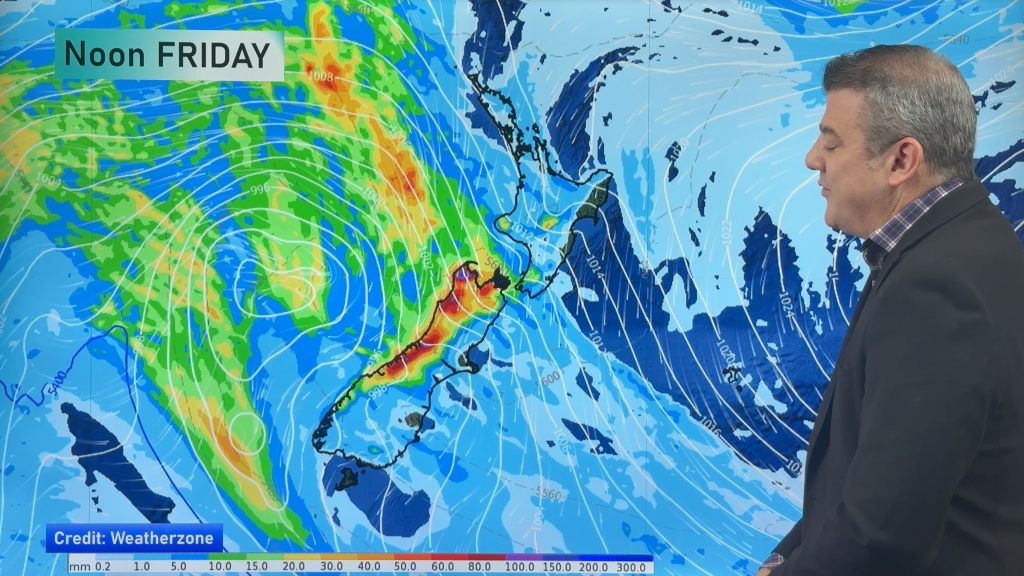
Milder winds will affect the nation over the next day or two as a messy low pressure zone moves in and high pressure moves out. Rain will be heaviest along the western South Island with some spillover into northern and eastern regions. The North Island also has some rain and showers, possibly a few heavy downpours, as it tracks through late week and going into Saturday.
By Sunday and Monday a cooler/colder airflow will cover most regions and winds ease going into next week bringing frost potential – all ahead of the next powerful high pressure zone.
Comments
Latest Video

Rain & showers this weekend, colder change next week
Some places will warm up over the next day or so as a nor’wester out of Australia moves across NZ,…
Related Articles
Rain & showers this weekend, colder change next week
Some places will warm up over the next day or so as a nor’wester out of Australia moves across NZ,…

Temperature changes for some regions ahead of heavy West Coast rain
A nor-wester is about to kick in and it’s coming from out of Australia, boosting temperatures in some regions going…

NZ 7 day forecast: Showers, temp changes and heavy West Coast rain
NZ has a fairly messy forecast over the next 7 days, but the main feature will be heavy rain on…


Wayne on 6/05/2026 11:34pm
Thanks again for the update on what weather we can expect through till after the weekend.