Tropical low pressure may influence NZ’s weather from next week
14/01/2026 9:49pm
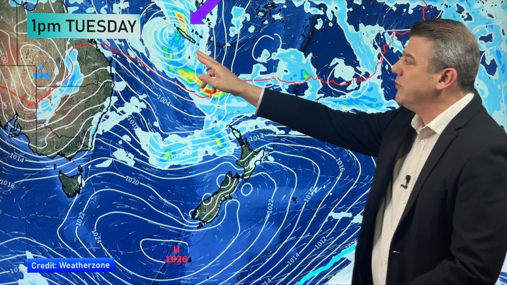
Low pressure covers central and northern parts of NZ today with higher humidity and downpours and hit and miss thunderstorms, with cooler airflows coming in to the south and east over the coming weekend. The cooler airflow is due to high pressure that will be situated south of New Zealand, dredging up subantarctic air in some regions.
But next week a low pressure zone leaving the tropics (around New Caledonia) may form into a tropical cyclone and drift southwards towards NZ. It’s likely the anticyclone south of NZ will affect the tracking of this low – and while the forecast one week from now is not yet locked in, the latest maps do suggest rain, wind and tropical humidity may affect the North Island.
We track the temperature changes, upcoming rainfall, and where high and low pressure is expected to be over the coming 8 days.
Comments
Latest Video

Update on incoming cold change for NZ
High pressure still covers NZ but that will slide offshore as we go into Friday and the weekend as a…
Related Articles
Update on incoming cold change for NZ
High pressure still covers NZ but that will slide offshore as we go into Friday and the weekend as a…

Wintry blast coming this weekend, everyone will feel the temperature drop
A significant cold change is coming in this weekend, starting as early as Friday for the lower South Island and…

Tracking the showers & a potential wintry blast late next week
NZ is on the edge of high pressure with anticyclones moving through at times over the next several days bringing…


Les young on 15/01/2026 5:02am
I look at the weather forecast a lot with Phillip Duncan. But please do we have to have Kiora and I would prefer New Zealand, not Aotearoa,I suppose I could find another weather channel if it annoys me. But I don’t want to because I like him 😀👋
WW Forecast Team on 15/01/2026 7:36am
Hi Les, maybe focus on the 8 minutes of weather video rather than the first 1 second.
Cheers
Phil
josh on 14/01/2026 9:58pm
la nina giving nz a patchy/messy summer. hopefully that low doeesnt produce a “auckland anniversary flood or gabrielle” scenario no high after high after high this summer its seem to be low high low high low high for some reason. might not need to worry about drought this year though.