Cold front incoming, rain, showers and thunderstorms in the mix
4/06/2026 12:04am
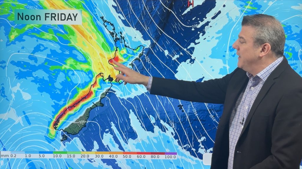
Low pressure in the Tasman Sea is moving into the South Island and will bring more heavy West Coast rain and some spillover into the upper South Island, then western and northern parts of the North Island with isolated downpours and thunderstorms going into Saturday.
On Saturday a colder southerly spreads up the South Island and into the lower North Island and by Sunday all of NZ will be under a cooler/colder set-up. The Chatham Islands, Southland and Otago are most exposed to the wintry weather with snow on the mountains and ranges in the South Island.
But next week we’re back to high pressure again, which should arrive over NZ by mid-week and may linger through next weekend and into the following week.
Latest Video

Tracking the showers & a potential wintry blast late next week
NZ is on the edge of high pressure with anticyclones moving through at times over the next several days bringing…
Related Articles
Tracking the showers & a potential wintry blast late next week
NZ is on the edge of high pressure with anticyclones moving through at times over the next several days bringing…

Some polar airflows but more high pressure to affect NZ’s weather
Showers are in the forecast over the next several days, we track where and when they occur – but there…

Tracking the showers & colder changes
High pressure isn’t over NZ, but is nearby – and it’s affecting our airflows and who gets wet weather and…

