Tropical Cyclone Niran intensifying (+5 Maps)
2/03/2021 8:56pm
> From the WeatherWatch archives
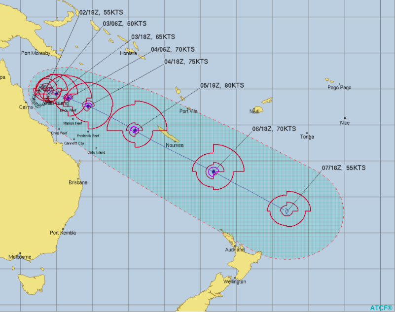
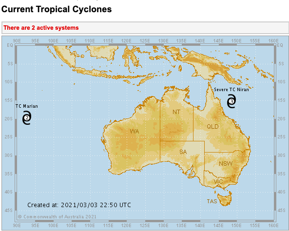
Cyclone Niran remains in the Coral Sea area.
It will continue to bring rain, wind and rough seas to parts of Queensland, but in the day or two ahead will start to pull off the Australian coastline and more out to sea.
It’s currently over sea surface temperatures of 29.5 degrees C which is ripe for fuelling a tropical storm.
New Caledonia is expecting to get a direct impact by the cyclone this weekend, with damaging gales and flooding rains – also coastal inundation and erosion is possible. The cyclone may impact the entire nation.
As for New Zealand, the risk looks low of a direct threat due to growing high pressure in the Tasman Sea area and a big southerly flow over the NZ area. The Chatham Islands may end up getting some of the leftovers as it possibly combines with a much larger southerly low that is expected to intensify this weekend in the NZ area.


Latest Video

NZ: 8 Day outlook as gales & rain ease, high pressure builds
Damaging wind gusts and heavy rain will continue to affect some parts of the North Island and brushing Marlborough today…
Related Articles
NZ: 8 Day outlook as gales & rain ease, high pressure builds
Damaging wind gusts and heavy rain will continue to affect some parts of the North Island and brushing Marlborough today…

Pockets of hit & miss heavy rain, snow moves northwards
Low pressure continues to slowly move across the upper North Island and for some that will bring the sun out,…

Slow go for northern low & southern cold
For the next few days low pressure will crawl over the upper North Island, driving in rain as far south…

