Colder change moving in this weekend, frosts for some next week
7/05/2026 11:32pm
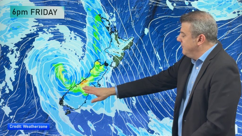
Low pressure will cross over the South Island on Friday night bringing more heavy rain to western and northern parts of the island and some spillover into the east too. The North Island has showers and patchy rain developing tonight, but the front will break up as it moves over the north.
Thunderstorms are likely off the Tasman Sea with heavy downpours, they will be more isolated for the North Island.
The colder change arrives in the South Island over Saturday and by Sunday all of NZ should have the colder winds, bringing in frost potential to the South Island by Monday morning and then potentially into the North Island next week.
High pressure is moving towards southern NZ by the end of next week bringing drier weather to most regions, but some showers will continue in Southland, Hawke’s Bay and Gisborne areas in particular.
Latest Video

NI low pressure, SI polar change
Low pressure will move over the upper North Island this week, bringing hit and miss pockets of heavier rain into…
Related Articles
NI low pressure, SI polar change
Low pressure will move over the upper North Island this week, bringing hit and miss pockets of heavier rain into…

Rain & showers this weekend, colder change next week
Some places will warm up over the next day or so as a nor’wester out of Australia moves across NZ,…

Temperature changes for some regions ahead of heavy West Coast rain
A nor-wester is about to kick in and it’s coming from out of Australia, boosting temperatures in some regions going…

