NZ 7-Day: Showers and a windier, cooler, southerly flow on the way
21/01/2026 11:09pm
Heavy rain continues in parts of the South Island today as the ex-tropical low drifts down over the eastern North Island and will push out to sea later this afternoon and evening, getting stronger as it does so – but also moving further offshore. Rain has eased in a number of North Island regions but drizzle and showers can still be expected, especially in the west (or the western side of the hills and ranges), along with windy westerlies developing.
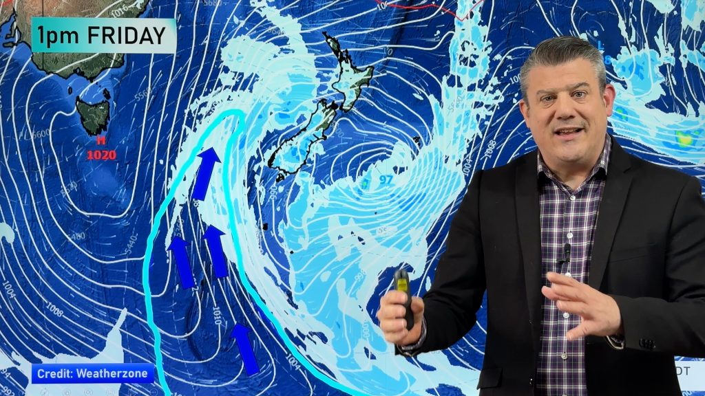
As we go into Friday PM and Saturday AM a colder southerly change moves up the South Island with a dusting of snow likely on the peaks of the Southern Alps on Friday night (above about 1800m). Humidity eases further for those in the north where it has been very muggy for the past day or two. Single digit overnight lows are expected across inland parts of the South Island and Central North Island on Saturday morning, but winds in the North Island will have more of a westerly lean to them – helping dry out eastern areas of the upper North Island.
This set-up remains on Sunday and Monday too – with perhaps a few inland thunderstorms or downpours forming but large dry areas in the mix.
By the middle of next week drier weather is likely in many regions with lighter winds – but the unsettled weather pattern may not fully clear until the end of January when, hopefully, we’ll again see an uptick in high pressure exiting Australia for New Zealand.
Comments
Latest Video

Cold weekend, frosts return with high pressure, then a low late next week
The subantarctic airflow spreads over NZ today/tonight and into Saturday, dropping temperatures nationwide. Snow flurries are possible today to lower…
Related Articles
Cold weekend, frosts return with high pressure, then a low late next week
The subantarctic airflow spreads over NZ today/tonight and into Saturday, dropping temperatures nationwide. Snow flurries are possible today to lower…

Wintry burst of weather: Snow, squally showers then sunshine & frosts
A polar change (another one!) arrives on Friday for the South Island and goes nationwide on Saturday, leaving NZ under…

Antarctic southerly for parts of NZ Fri & Sat
For the first time this year a southerly from off Antarctica is heading towards the South Island, followed by more…


Jane Orchard on 22/01/2026 9:52pm
I live in Northern Buller. We have had almost no rain despite what the forecasts predict. When you forecast south east rain with heavy rain, we know you’re on the wrong track because that just doesn’t happen. Westport could easily be wiped out by a flood so when you predict heavy rain a lot of people panic. It normally doesn’t happen and that’s just cruel. Please can you be more conservative in your forecasts of heavy rain for us.
WW Forecast Team on 22/01/2026 10:52pm
Hi Jane, any wet weather with south-easterlies is usually in the form of inland downpours or thunderstorms, in this case due to some low pressure crossing the South Island bringing instability and hit and miss downpours. Always check your local rainfall totals for more detail and track on rain radar as they can form over the mountains then drift over the valleys. MetService thunderstorm outlook: https://www.weatherwatch.co.nz/maps-radars/lightning/thunderstorm-outlook
Kind regards
– WW
Edit: There has been slow moving heavy rain in Buller.
Warren Heslip on 22/01/2026 5:17am
thank you for the most accurate forecast i can find as a spraying contractor.