Colder air for Wed/Thu + your Anzac Day & long weekend weather
22/04/2026 12:51am
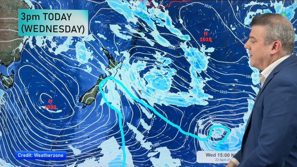
Rain, showers, some snow then possible frosts are in the forecast for the next 24 hours as the low that has been bringing pockets of severe weather starts to move east of the country. Between this low and a large high over the southern Tasman Sea this is dredging up a cold south-easterly flow over NZ, dropping temperatures further tonight and going into Thursday.
But high pressure is trying to move in and will bring lighter winds and drier skies to most places on Anzac Day (Saturday). The long weekend may have some wind and showers for a time in both islands, but we’re seeing long dry spells and calmer conditions generally speaking.
We break down New Zealand’s weather between now and Tuesday of next week, plus a rainfall map to make sense of the showers.
Latest Video

Polar airflows set to bring cold weekend to NZ
Nor-west winds will be building over parts of NZ going into Thursday with rain on the West Coast becoming heavy…
Related Articles

Wind, rain, showers & a noticeable temperature drop for all
It will be a colder weekend right across NZ as a sub-Antarctic southerly blows through, bringing frosts, snow flurries and…
Polar airflows set to bring cold weekend to NZ
Nor-west winds will be building over parts of NZ going into Thursday with rain on the West Coast becoming heavy…

Update on incoming cold change for NZ
High pressure still covers NZ but that will slide offshore as we go into Friday and the weekend as a…

