Severe Cyclone Niran rocketing past Noumea, New Caledonia (+7 Maps)
5/03/2021 11:53pm

> From the WeatherWatch archives
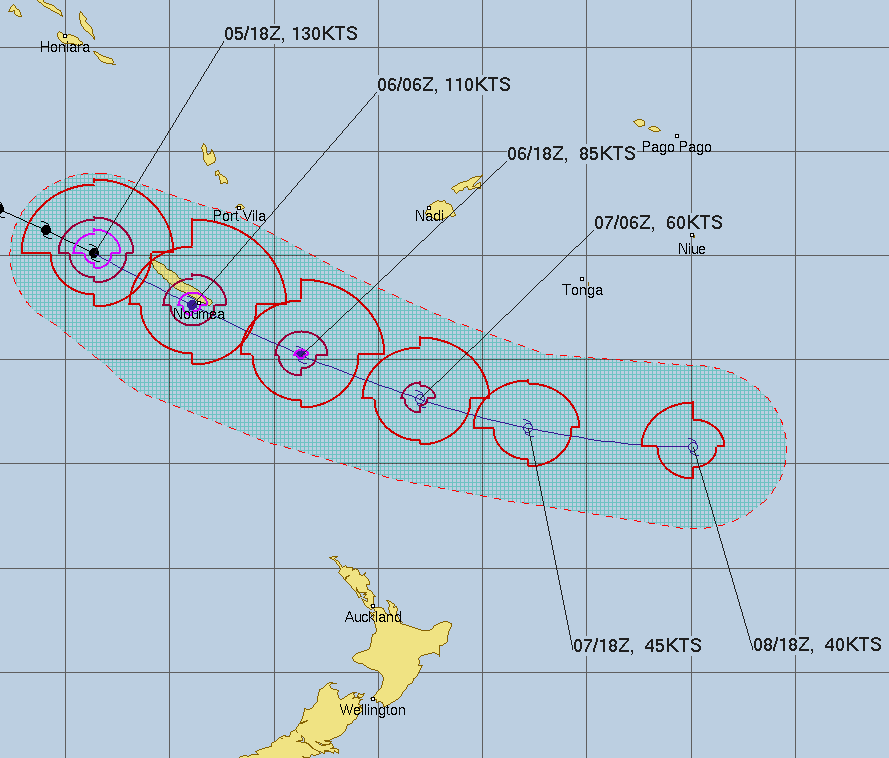
Updated 5:35pm NZDT / 3:35pm Noumea Time — Cyclone NIRAN is back to Category 4 after reaching top end Cat 5 this morning as it moves into New Caledonia.
The cyclone is tracking ESE extraordinarily fast at 46km/h. Some cyclones move at slower than human walking speed.
The Fiji MetService has now taken authority to track the storm as it has left Australian waters.
WeatherWatch.co.nz says Niran is an extremely dangerous tropical cyclone and has life threatening weather potential, but some positive news is that the centre of the cyclone, with the worst of the winds, is mostly just to the south of New Caledonia, sparing the nation from the worst of Narin’s power.
Niran’s track today will see it running parallel to the southern coastline of New Caledonia, reaching Noumea early this evening New Zealand time (around 3 to 5pm Noumea time).
Earlier when Narin was at Category 5, maximum wave heights were approaching 15 metres (48 feet) to the west of New Caledonia with winds sustained at 240km/h and gusting 300km/h. The cyclone is weakening now and the very fast movement of the entire storm will limit damage in New Caledonia too.
But, Niran is still a severe potentially deadly storm. Everyone across New Caledonia should now be in shelter. Niran is expected to retain severe Category 4 strength as it passes very close to Noumea in the next hour or so. Central air pressure by then should still be very low, around 955hPa.
The cyclone is likely to depart this evening with winds and rain both easing tonight/overnight.
WeatherWatch.co.nz says Cyclone Niran isn’t expected to impact New Zealand due to expanding high pressure in the Tasman Sea.


Latest Video

NZ: 8 Day outlook as gales & rain ease, high pressure builds
Damaging wind gusts and heavy rain will continue to affect some parts of the North Island and brushing Marlborough today…
Related Articles
NZ: 8 Day outlook as gales & rain ease, high pressure builds
Damaging wind gusts and heavy rain will continue to affect some parts of the North Island and brushing Marlborough today…

Pockets of hit & miss heavy rain, snow moves northwards
Low pressure continues to slowly move across the upper North Island and for some that will bring the sun out,…

Slow go for northern low & southern cold
For the next few days low pressure will crawl over the upper North Island, driving in rain as far south…

