Tropical low: Heavy rain, strong winds, tropical humidity – then a colder southerly this weekend
19/01/2026 11:18pm
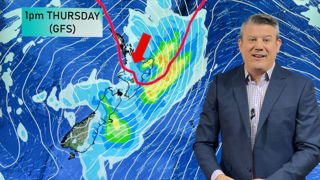
We have full details on the tropical low moving into New Zealand as we track the heaviest rain, the strongest winds, and which areas (and when) receive the tropical humidity before a more refreshing westerly arrives across Thursday.
By Friday and into the weekend this low lies east of the South Island and will continue to strengthen, coupled with high pressure nearer to Australia this will dredge up a colder/cooler/refreshing change – but it may even bring a dusting of snow to the Southern Alps around Friday/Saturday.
Monday next week still has a southerly – but it’s hopefully easing by then as high pressure finally starts to move closer to NZ. We have another video update out later today about the longer range forecast for the end of January and start of February due to so many people asking us when the “summer weather” will return… or even show up for the first time in some places!
Keep up to date with MetService warnings and watches, more are likely to be issued today and tomorrow as this tropical low moves in bringing stormy weather.
Latest Video

Antarctic southerly for parts of NZ Fri & Sat
For the first time this year a southerly from off Antarctica is heading towards the South Island, followed by more…
Related Articles
Antarctic southerly for parts of NZ Fri & Sat
For the first time this year a southerly from off Antarctica is heading towards the South Island, followed by more…

Meteors – Your Eyewitness Reports!
WeatherWatch.co.nz receives meteor reports from all over New Zealand and the globe, 24/7/365. **CASUAL COMMENTS**If you’ve seen something in the…

Snow, rain showers & cold polar southerlies set to return
Friday will be a wintry day across NZ as the next cold front arrives, bringing snow to lower levels of…

