NZ VIDEO: Windy westerlies to surge back, chance of thunderstorms this week
8/09/2025 12:20am
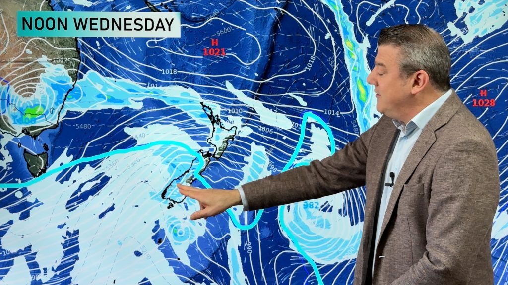
High pressure covers much of the country today, but a windier burst of weather is coming back – with more polar air around the South Island in particular. It’s not a major week of weather – but there are severe weather risks into both main islands.
Frosty weather is also possible this week, again mainly around the South Island but some risks into the North Island – especially tonight/Tuesday AM.
We have your NZ forecast through to Sunday and surges of windy westerlies move into the country.
Comments
Latest Video

Cold weekend, frosts return with high pressure, then a low late next week
The subantarctic airflow spreads over NZ today/tonight and into Saturday, dropping temperatures nationwide. Snow flurries are possible today to lower…
Related Articles
Cold weekend, frosts return with high pressure, then a low late next week
The subantarctic airflow spreads over NZ today/tonight and into Saturday, dropping temperatures nationwide. Snow flurries are possible today to lower…

Wintry burst of weather: Snow, squally showers then sunshine & frosts
A polar change (another one!) arrives on Friday for the South Island and goes nationwide on Saturday, leaving NZ under…

Antarctic southerly for parts of NZ Fri & Sat
For the first time this year a southerly from off Antarctica is heading towards the South Island, followed by more…


Juliet Batten on 8/09/2025 1:56am
Are these bursts of high winds and low temperatures a sign of global warming, especially of the sea temperatures?
We seem to be having a windier spring this year with chillier contrasts to the few fine days. (in Auckland)
WW Forecast Team on 8/09/2025 2:10am
Hi Juliet,
Spring is all about winter *slowly* fading away and hints of summer *slowly* coming in. Windy westerlies in spring is one of the season’s defining features. In fact it’s text book spring weather. In saying that, sea surface temperatures are up – there are marine heatwaves around NZ at the moment, including Auckland, which is part of a global trend in sea surface temperatures in recent years.
Our latest ClimateWatch Video (for the month of September) explains what is happening at the moment: https://www.youtube.com/watch?v=bdiUwvsGBZU
Cheers,
– Phil D
p.s. Auckland has had a colder end to winter/start to spring than the past several years (but it’s perhaps more noticable at the moment because previous years were warmer than usual).
Juliet Batten on 8/09/2025 3:20am
Thanks so much Philip. I missed the September video but have just caught up with it.
I write about the seasons so like to stay informed.
Yours is my go-to place for weather information. A great site, and you explain things brilliantly. I’m understanding so much more about weather since becoming a fan of WeatherWatch.