NZ VIDEO: Snow, rain showers and polar air – then frosty and dry
17/08/2025 11:27pm
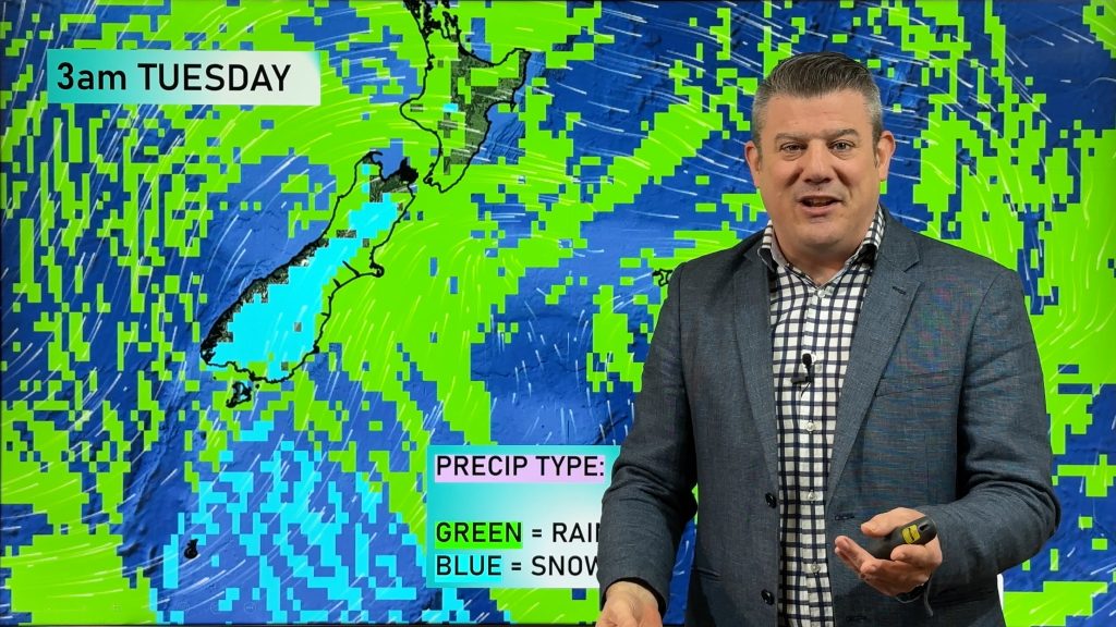
A cold blast that is affecting Aussie is now moving into NZ overnight tonight and across Tuesday, bringing snow to low levels in the South Island and to just 300 or 400m into the North Island for a time.
In the South Island snow levels may get down to 100 or 200m overnight/Tuesday AM, although heavy snow is mainly above 400m and clears away quite fast going into Wednesday.
Later this week huge high pressure out of Australia will move in – bringing drier weather for most places, but also colder nights again. We have your New Zealand forecast out to Sunday.
Latest Video

Polar airflows set to bring cold weekend to NZ
Nor-west winds will be building over parts of NZ going into Thursday with rain on the West Coast becoming heavy…
Related Articles

NZ: Cold & windy, then calm & frosty
Downpours, some squally with the chance of thunderstorms and even small tornadoes are possible for parts of NZ over Friday…

WeatherWatch App launches real-time local lightning tracker
A bolt out of the blue! WeatherWatch has launched a live, real-time lightning tracker, enabling Kiwis to gain access to data provided by the…

Wind, rain, showers & a noticeable temperature drop for all
It will be a colder weekend right across NZ as a sub-Antarctic southerly blows through, bringing frosts, snow flurries and…

