North Island in for direct hit from ex-cyclone Hale Tue/Wed (+15 Maps)
9/01/2023 9:48am

> From the WeatherWatch archives
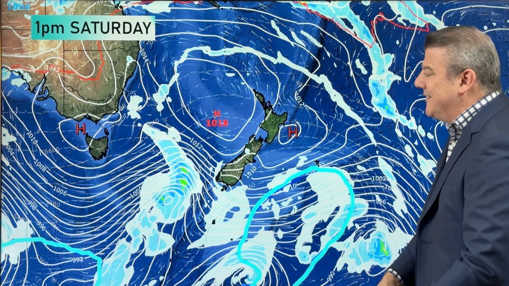
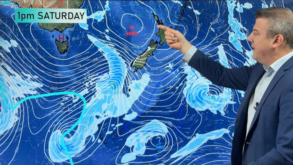
Updated 10:48pm Monday — HALE became an ex-tropical cyclone early Monday morning but it’s expected to strengthen into an extra-tropical storm in the NZ area on Tuesday – bringing a surge of severe gales and heavy rain across the North Island for 48 hours, before departing to the south east by late week. Most places will likely only have severe weather for 12 to 24 hours.
HALE officially wasn’t a tropical cyclone for even 24 hours, making it just over half a day before losing it’s official named status. Hale was never expected to be a major storm though – and the real issue for New Zealand has always been what would happen to it once it reaches here and redevelops into an extra-tropical system.
All tropical cyclones that reach NZ lose their official “tropical cyclone” status at some point, usually just north of Northland – then the storm changes into an extra-tropical storm, this can make the system rapidly grow in size and whilst it loses some intensity at the centre, it grows much larger overall (put another way, the energy gets spread further from the centre).
The remnants of what was Cyclone Hale will bring another burst of severe weather to North Island camping grounds and holiday spots – but the good news is that it’s unlikely to stick around with most forecasts expecting it to leave NZ on Thursday.
The storm brings with it the risk of slips, flooding, power cuts, trees down and road closures.
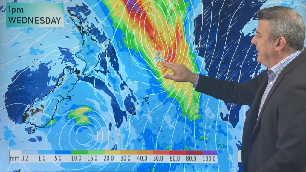
The centre of the low is expected to move into Northland, Auckland, Coromandel Peninsula and Bay of Plenty on Tuesday night/overnight Tuesday/Wednesday morning – then it drifts down the North Island and will morph into a new shape as it pulls away from NZ on Thursday to the south east. (out over the Pacific Ocean and away from NZ).
DEVELOPING – This is a developing story and we will have regular updates over the coming days here at WeatherWatch.co.nz and RuralWeather.co.nz.
GALES
East to ESE winds will build in the upper North Island on Wednesday – tracking southwards. They are likely to be severe in some exposed areas
Three additional ways to track the severe winds:
- 1) Use the wind maps from PredictWind. Red and dark red indicates gales and damaging gales
- 2) Keep up to date with MetService severe weather warnings
- 3) Use the wind graphs at RuralWeather.co.nz which clearly show peak gust times
RAIN
Ex-tropical cyclones can drop a lot of rain, this one is no different and could drop 100 to 250mm in just two days for some eastern ranges (Coromandel Peninsula and East Cape/Gisborne most exposed to the highest totals).
Three additional ways to track the rain
- 1) Use the rain accumulation maps we have at WeatherWatch.
- 2) Keep up to date with MetService severe weather warnings
- 3) Use the daily rainfall totals at both WeatherWatch.co.nz and RuralWeather.co.nz
MOST IMPACTED
The low/storm is expected to make a direct hit into the North Island on Tuesday night and Wednesday morning. Most affected at this stage:
- Eastern and southern parts of Northland
- Auckland, mostly north of the CBD
- Eastern Waikato
- All of Coromandel Peninsula
- Western Bay of Plenty
- East Cape & Gisborne
- Hawke’s Bay
- Maybe Wairarapa
- Cook Strait Area for gales
Please note, other regions may have severe weather too from this storm.
Keep up to date with the latest MetService severe weather watches and warnings for New Zealand.


- WeatherWatch.co.nz
Comments
Before you add a new comment, take note this story was published on 9 Jan 2023.


Add new comment
Scott on 9/01/2023 5:37am
Where is our Phil and his great explaining videos when we need him? Surely this is worth coming back from holiday to report on? Really miss the videos, especially when something like this crops up.
Reply
Mitchell Lowe on 8/01/2023 11:29pm
Looking like we will be getting some strong winds here in tokoroa
Reply
Phil Smith on 8/01/2023 9:38pm
Hi Phil, this system must be very slow as according to some of your maps we should be experiencing some rain and we have a blue sky with dotted clouds a very little wind in Levin
Reply
WW Forecast Team on 8/01/2023 10:15pm
Hi Phil, the blue over levin in the 24 hour rain map below = a spit or light drizzle patch anytime between now and 7am Tuesday morning. It’s most likely tomorrow not today (maps covers from 7am Mon to 7am Tue).
Cheers
WW Team
Reply