Storm finally easing, a cold front Friday, then high pressure this weekend
16/02/2026 11:36pm
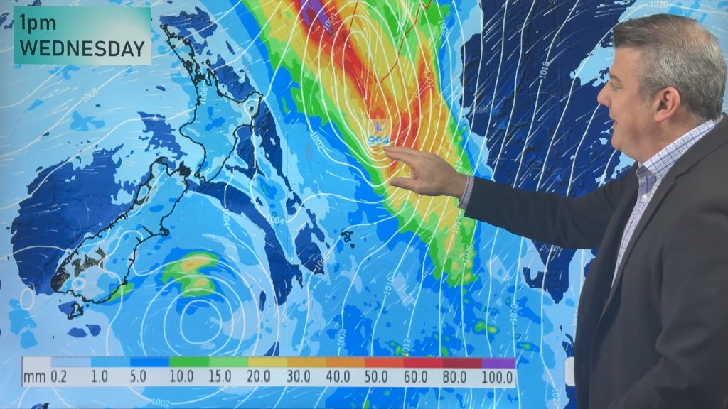
One storm is unwinding, while another subtropical storm is powering up – but this will miss much of NZ, but make a direct hit (or near hit) to Chatham Island on Thursday. It’s fast moving but wind and dangerous seas may be an issue for a time.
The South Island and North Island will have a west to south-west flow kicking in over the days ahead, bringing western showers – and a cold front on Friday will drop temperatures in the lower South Island in particular, and make for windier weather through the mountains and central NZ.
This weekend high pressure moves in, bringing a settled Saturday for most, but on Sunday westerlies pick up around the South Island and lower North Island with some West Coast rain or showers, and perhaps for Southland too as another weak cold front moves in.
Next week kicks off with more high pressure and warmer nor’westers for the lower South Island.
Latest Video

Wintry weather coming: Snow, rain, wind & sunshine
A cold front is moving into NZ from Friday to Sunday with low pressure developing west of NZ and then…
Related Articles

Polar airflow + northern low = pockets of heavy rain & snow
A colder change is coming – and so too is a large low which will develop and grow over northern…
Wintry weather coming: Snow, rain, wind & sunshine
A cold front is moving into NZ from Friday to Sunday with low pressure developing west of NZ and then…

ClimateWatch: JULY outlook & what El Niño means for NZ
El Niño is officially here and still getting stronger in the months ahead, but it’s harder to notice its effects…

