Cold fronts and high pressure – a fairly standard late February forecast
18/02/2026 10:51pm
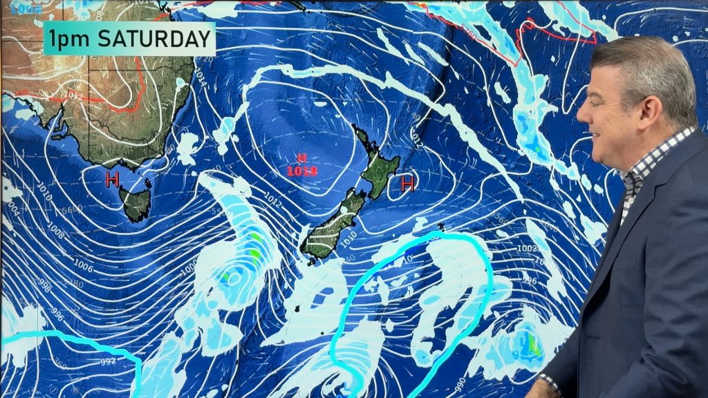
High pressure is increasing around New Zealand this weekend and next week – but it won’t always be centred over us, allowing for cold fronts to bump into the country every couple of days. It’s a bit of an on again, off again, set-up with showers and westerlies, followed by lighter winds and mostly dry.
Generally speaking the risks for severe weather look much lower than they have in recent weeks, with some West Coast rain and a few showers, possibly heavy, sneaking into other regions at times. But with high pressure north of NZ it will effectively stop subtropical weather from affecting us, and encourage more westerlies and southerlies into the country every couple of days.
We track the ups and downs over the next 8 days.
Programming Notes:
– We have NO VIDEO tomorrow/Friday.
– Next video update will be on Monday and it’s possible that Monday’s video may be published a little later in the afternoon.
Comments
Latest Video

Large low brings rain, downpours & some snow – gets colder as the week progresses
Low pressure will cross the upper North Island in the days ahead and that set-up actually pushes more heavy rain…
Related Articles
Large low brings rain, downpours & some snow – gets colder as the week progresses
Low pressure will cross the upper North Island in the days ahead and that set-up actually pushes more heavy rain…

WeatherWatch App launches real-time local lightning tracker!
A bolt out of the blue! WeatherWatch has launched a live, real-time lightning tracker, enabling Kiwis to gain access to data provided by the…

Polar airflow + northern low = pockets of heavy rain & snow
A colder change is coming – and so too is a large low which will develop and grow over northern…


Greg (surfer) on 19/02/2026 9:35pm
Snow on the hills around Queenstown this morning with more on the way tomorrow: this is now the 4th year-in-a-row I’ve enjoyed a snowy ‘white birthday’ in February, which used to be hot & sunny, but these days it’s brisk & snowy.
Coldest Summer Ever? or
The Year Without A Summer?