Nearby lows may siphon energy from expected tropical cyclone – may mean more rain for NZ
11/12/2021 2:11am

> From the WeatherWatch archives
A tropical depression moving over the Coral Sea this weekend is forecast to become a tropical cyclone and may reach “severe” Category 3 status (or stronger) in the coming days.
The storm is expected to make a direct or very near track to New Caledonia and the southern islands of Vanuatu and if the storm does make it to Category 3 then damage may be significant there.
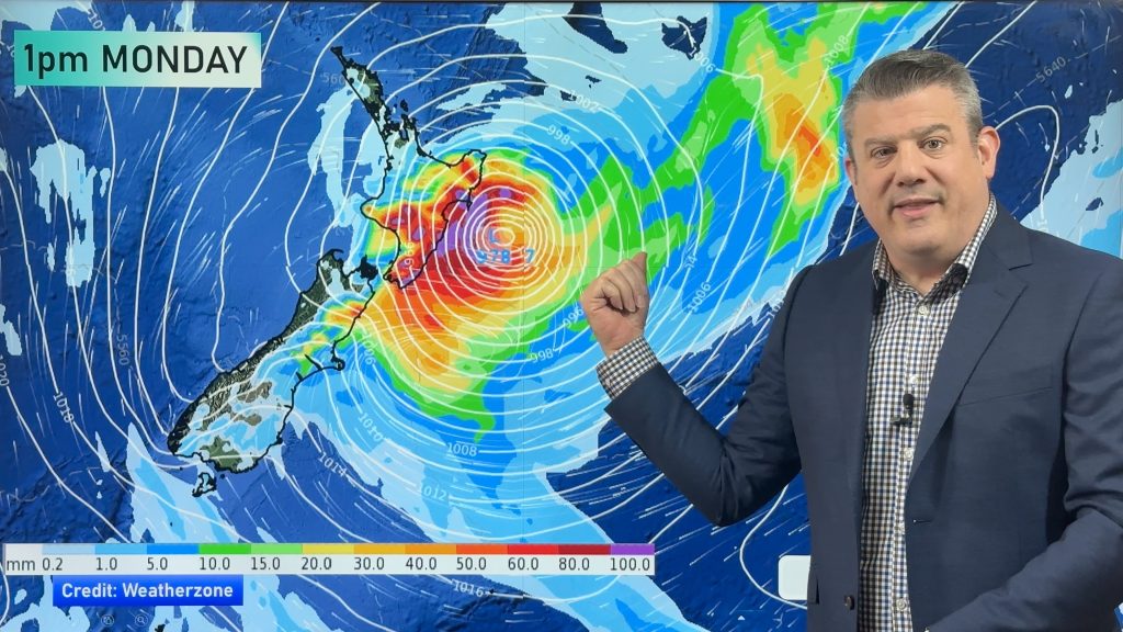
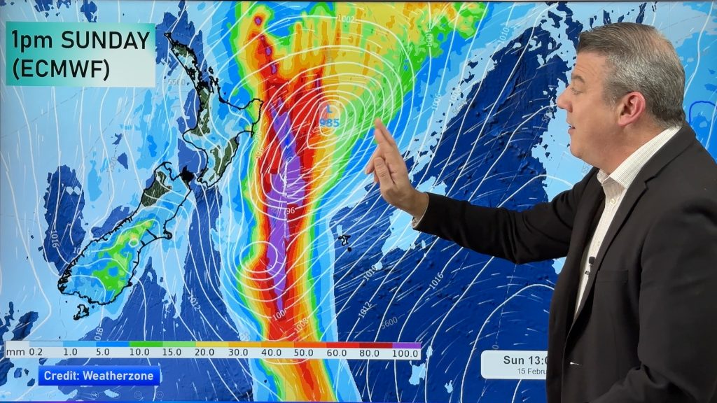
However the path closer to New Zealand gets much more complicated due to other lows nearby in the NZ region. It’s not that unusual for a tropical storm to have another nearby low ‘steal’ energy from it. While this siphoning of energy can reduce wind speeds (and therefore reduce the potential strength/category of the cyclone overall), it can actually boost rainfall, making a much larger and slower area of tropical rain.
Certainly by Wednesday of next week a humid northerly flow will spread from the Equator to Fiji then down over parts of New Zealand likely bringing 100% humidity at times here.
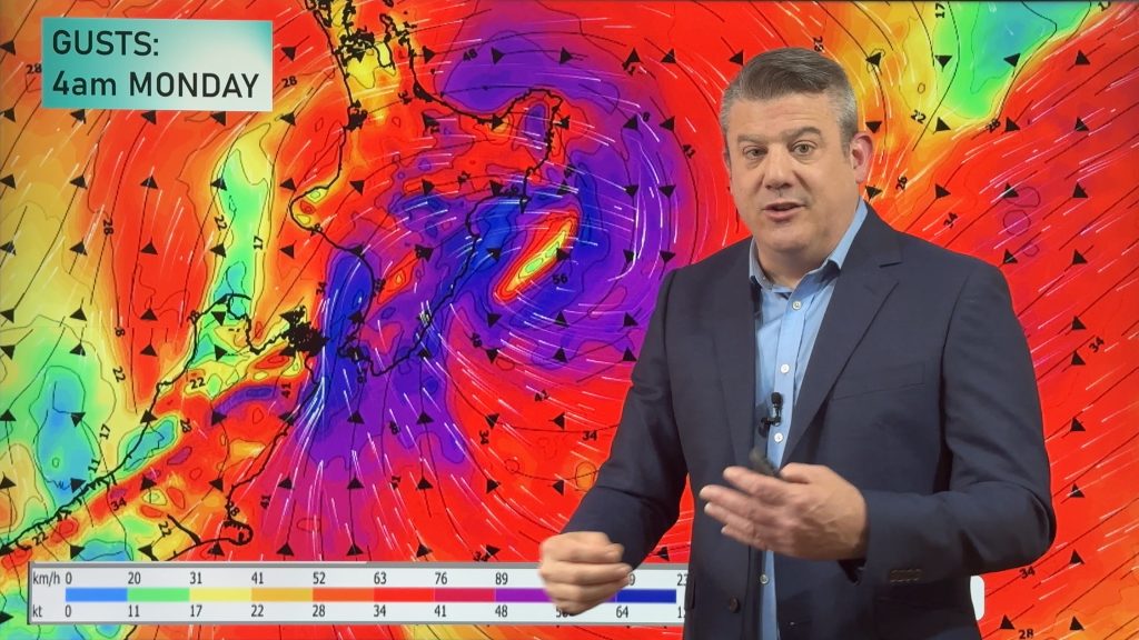
Computer modelling has been confident for over a week now that a tropical cyclone (which will be technically an ex-tropical cyclone by the time it gets closer to NZ, as the core shifts from warm air to cold air) will track over or near the North Island out to the east. Some models show it even further offshore, but still close enough to bring dangerous beach conditions to some eastern beaches from Northland to Hawke’s Bay. Other modelling shows it dragging in a large, wet, area of low pressure without the stormy winds for all.
While the precise tracking is yet to be locked in, our forecasts here at WeatherWatch.co.nz and RuralWeather.co.nz utilise IBM Watson, a supercomputer that crunches all the reliable international models and gives you one simple forecast for your hyper-local part of NZ. This saves you the worry of focusing on particular weather models, which do chop and change each day with these sorts of storms (but those with a keen eye can see patterns in those chops and changes which helps with long range understanding of the tracking).
Already we’re seeing a risk for gales and heavy rain next week in the North Island in particular., but rain may cross much of NZ for a time too.
We’ll have more details on Sunday – and even more details from Monday.
Helpful Links:


WeatherWatch.co.nz – see your hyper local forecasts (powered by IBM) to make more sense of it all.
Comments
Before you add a new comment, take note this story was published on 11 Dec 2021.


Add new comment