Eastern & central NZ most exposed to severe gales, heavy rain, dangerous seas next few days
13/02/2026 10:56pm
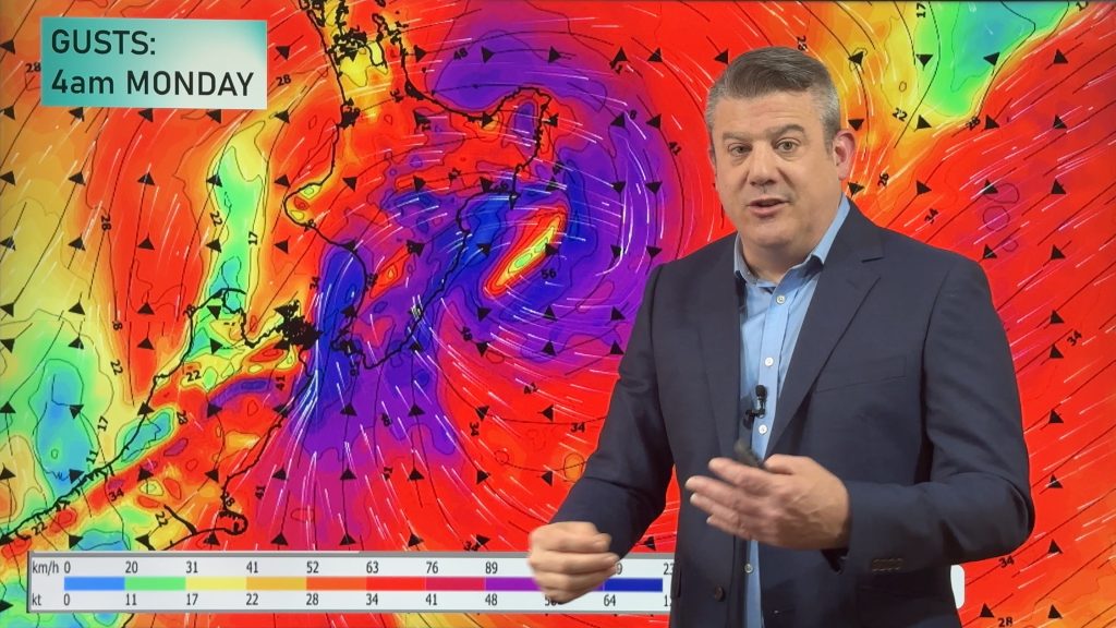
In this special Saturday update we track the low north of NZ that is expected to develop into a storm east of the North Island across Sunday and going into Monday.
Heaviest rain is likely to be in the eastern side of North Island and the southern half of the North Island and down to Marlborough and Canterbury in the South Island.
We show you the latest tracking, rainfall, damaging winds – and the expected wave heights at their peak.
Also, a longer range look towards the end of next week – plus Phil explains why lows north-east of NZ are triggering into larger systems at the moment.
We will update again on Sunday.
Keep up to date with MetService warnings – as rainfall maps are only a guide, and localised downpours can always create more rain than is forecast, as we saw overnight in Waikato.
Comments
Latest Video

Colder nights/mornings, polar change coming Sun/Mon
The nights and mornings ahead will be colder in a number of regions – but an even colder change is…
Related Articles
Colder nights/mornings, polar change coming Sun/Mon
The nights and mornings ahead will be colder in a number of regions – but an even colder change is…

Frosts, clearer skies coming – severe weather possible this weekend
High pressure lies south of NZ today and that placement encourages a colder south-east wind into the North Island bringing…

NZ: 8 Day outlook as gales & rain ease, high pressure builds
Damaging wind gusts and heavy rain will continue to affect some parts of the North Island and brushing Marlborough today…


Allan B on 14/02/2026 9:32pm
Great update with loads of useful info, thanks. Just one little thing, it would be better to refrain from using “today” or “tomorrow” and use “Saturday” or ” Sunday” as it reduces confusion if you’re not sure when the video was recorded. Thanks.
Eva on 14/02/2026 8:49pm
Appreciate the weekend update. Spare a thought for us high on the South Coast of Welly with flying sewerage ocean spray and
e-coli atmosphere. Already very strong winds here and battening down for the afternoon.
Jamie on 14/02/2026 4:44pm
Just great that the WW team are staying on deck and keeping us informed of this very threatening weather event.
Thank you Phil & WW team.
Wazza on 14/02/2026 4:23am
Thanks Phil for the update on a weekend!
Waz
Christopher Randal on 13/02/2026 11:01pm
60mm in Waharoa since midnight.
Skies are getting brighter now.