Monday’s temperature drop, latest on tropical low, + more high pressure in early March
25/02/2026 10:51pm
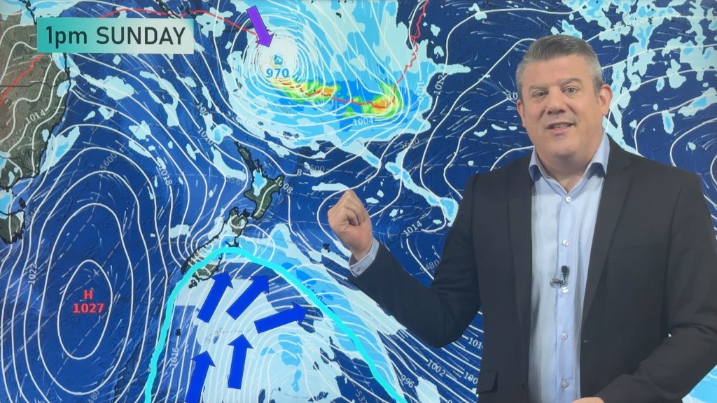
A cold front is today moving up the South Island, falling apart over the North Island going into Friday/Saturday. On Sunday an even colder change will move up NZ, dropping temperatures going into Monday and making for a cooler/colder Tuesday morning.
While all of this is happening a tropical low will be exiting the tropics, and likely will remain north-east of NZ as it passes by early next week. For now it poses no real threat to New Zealand, but is one to keep an eye on.
Next week, warmer, drier, weather moves back in as high pressure grows again – lifting temperatures following the colder/cooler start to the week.
+ We have a 7 day rainfall map to make sense of it all.
**SMALL ERROR** – Please note on the Monday map Phil accidently says “eastern Northland” instead of “western Northland” with regards to where the driest weather should be.
Latest Video

Tracking the showers & a potential wintry blast late next week
NZ is on the edge of high pressure with anticyclones moving through at times over the next several days bringing…
Related Articles
Tracking the showers & a potential wintry blast late next week
NZ is on the edge of high pressure with anticyclones moving through at times over the next several days bringing…

Some polar airflows but more high pressure to affect NZ’s weather
Showers are in the forecast over the next several days, we track where and when they occur – but there…

Tracking the showers & colder changes
High pressure isn’t over NZ, but is nearby – and it’s affecting our airflows and who gets wet weather and…

