Mid-upper 30s this weekend, cool down Monday, + tropical low to monitor next week
8/01/2026 11:16pm
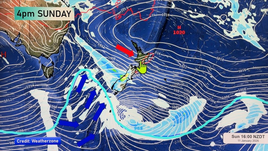
A burst of Australian and subtropical heat is coming to NZ, starting today and easing early Monday, brought in by windy nor’westers which peak in strength on Sunday.
For some eastern areas, such as inland parts of central Hawke’s Bay, the mercury may be closer to 40 degrees if conditions pan out perfectly. Western coastal areas of NZ will be warm, but without the excessive heat. The highest temperatures will be inland and/or leaning to the east.
Following Sunday’s heat, a cooler/colder change moves in, especially for the lower half of the South Island on Sunday night and Monday morning.
Next week more high pressure moves into the NZ area – but we’ll then be monitoring the tropics with a potential tropical cyclone (or depression) around Vanuatu and New Caledonia. While some modelling shows this storm hitting NZ, other models do not – so we will need to wait until Monday next week to lock in with more detail.
MetService may well be issuing not only rain and wind warnings, but excessive heat warnings too.
Comments
Latest Video

Westerlies continue, sub-tropical for some
West to north-west winds blow through the South Island and lower North Island today bring heavy West Coast rain and…
Related Articles
Westerlies continue, sub-tropical for some
West to north-west winds blow through the South Island and lower North Island today bring heavy West Coast rain and…

Westerly change this week, unsettled but large dry areas
Westerlies kick back in again this week which will bring a break to those in the east as far as…

Matariki, the long weekend + the outlook for next week
Wet weather and cloud continues along the eastern side of the country with the heaviest rain now moving into northern…


solace on 10/01/2026 11:49am
It’s a scorcher alright, but why is the sea temp so low.
Meanwhile GFS shows a cyclone around 20th Jan… https://www.tropicaltidbits.com/analysis/models/?model=gfs®ion=swpac&pkg=mslp_pcpn&runtime=2026010912&fh=6