
Westerlies continue, sub-tropical for some
14/07/2026 12:40pm
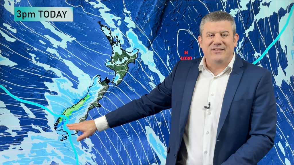
West to north-west winds blow through the South Island and lower North Island today bring heavy West Coast rain and thunderstorms. While large parts of the North Island are drier, there is a front clearing today to the east and a few showers possible behind it.
Showers continue off and on this week, especially in western regions of both main islands. Eastern areas are drier and milder than they have been but it may be a bit windy today and there are a couple of colder pulses of air for the lower half of the South Island and out over the Chatham Islands coming in over the days ahead.
We’re also monitoring a low pressure zone developing around the Coral Sea and New Caledonia – most models don’t currently have it forecast to reach NZ but it’s worth keeping an eye on (due to it’s placement), but for now the next large and strong high pressure zone out of Australia is likely to be moving into NZ from the Tasman Sea for the start of next week. We’ll update you tomorrow with the latest.
Want to track the thunderstorms in real time and get push notifications for lightning? Upgrade in our App – details here – www.weatherwatch.co.nz/mobile-app.
Latest Video
Hotter, but Wintry Snap coming late week
Temperatures will soar into the mid to late 20s early week but single digits for some by late week as…
Related Articles
Hotter, but Wintry Snap coming late week
Temperatures will soar into the mid to late 20s early week but single digits for some by late week as…
NZ: Instability to produce some wet weekend weather, cold change next week
Afternoon downpours will expand on Saturday with possible isolated thunderstorms as atmospheric instability (due to lower pressure zones east and…
Weekend downpours in both main islands, temps increase
Warmer air will spread over more parts of NZ this weekend but it will come with showers, some downpours and…

