Drier, calmer, warmer weather heading to NZ + the tropics wakes up (+6 Maps)
7/01/2020 8:12pm

> From the WeatherWatch archives
NZ is about to enter a calmer, drier, phase of weather as high pressure finally increases. At the same time the tropics north of NZ is starting to wake up with very active wet weather north of this high pressure belt – but the highs should keep these tropical lows and storms away from NZ for now.
We have high Number One rolling through this Friday and Saturday, which will encourage warmer sub-tropical northerly quarter winds over the North Island and parts of the South Island. This is short lived, especially in the South Island and lower North Island over Sunday and Monday as a cooler, windier, phase of weather returns.
But by next Tuesday high pressure Number Two should be spreading in across both islands and there are signs it may last a week, with warmer, calmer and sunnier weather for many regions. It appears to be a strong, solid, high. There may be a few showers here and there as a result of this set up though, especially inland downpours towards next weekend (not this coming one).
In 10 days time high pressure may be still in the New Zealand area, but at the same time low pressure will be growing north in the tropics. This may encourge a new easterly flow in the upper half of the North Island.
It’s worth keeping an eye on with the peak of the South Pacific Cyclone Season coming in around February and March but for now increased high pressure looks to be the main highlight of our January weather pattern.
NEXT 7 DAYS RAINFALL COMPARED TO NORMAL: Red = Drier than normal. White = Average rainfall. Blue = Wetter than usual.

THE SET UP:
JAN 14:
JAN 17:
JAN 20:
JAN 23: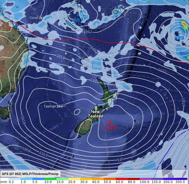
WeatherWatch.co.nz
Comments
Latest Video

Antarctic southerly for parts of NZ Fri & Sat
For the first time this year a southerly from off Antarctica is heading towards the South Island, followed by more…
Related Articles
Antarctic southerly for parts of NZ Fri & Sat
For the first time this year a southerly from off Antarctica is heading towards the South Island, followed by more…

Meteors – Your Eyewitness Reports!
WeatherWatch.co.nz receives meteor reports from all over New Zealand and the globe, 24/7/365. **CASUAL COMMENTS**If you’ve seen something in the…

Snow, rain showers & cold polar southerlies set to return
Friday will be a wintry day across NZ as the next cold front arrives, bringing snow to lower levels of…


Andrew Hill on 8/01/2020 9:15pm
Hi team
I am trying to work out the surf forecast for the 18th of January and I have noticed different predictions on the cyclone/Tropical Low track. METVUW is showing it coming in very close to the upper North Island, where as the GFS model above is different. Are you able to send a link to the maps you have above?
Andrew
WW Forecast Team on 8/01/2020 10:17pm
Hi Andrew, the best way to track a tropical cyclone is to watch the long range models for at least 3 or 4 days and work out some confidence. Most good forecasters tend to focus on GFS and ECMWF and learn them both individually. Once you understand them you tend to feel confidence one way or the other with each event. Every storm is unique and every time each model has a different run of accuracy. It’s a bit like the two best sports teams on earth competing – just because one isn’t good one time doesn’t mean it won’t be next time around.
The maps above are not allowed to be freely/openly shared (we purchase them) so there is no link, sorry. But we tend to publish the maps we believe are most accurate. GFS is only today showing a direct hit – yesterday there was a 1000km difference! ECWMF doesn’t support GFS today either so that makes today’s GFS map – so far anyway – a one off.
By the way – we have the exact same data as MetVuw (GFS) but our maps page does have links to the ECMWF general/public page. Good to use as a second opinion.
Cheers
Phil D