Windy, wet, mild weekend for many ahead of Monday’s polar blast (+6 Maps)
24/06/2021 11:54pm

> From the WeatherWatch archives
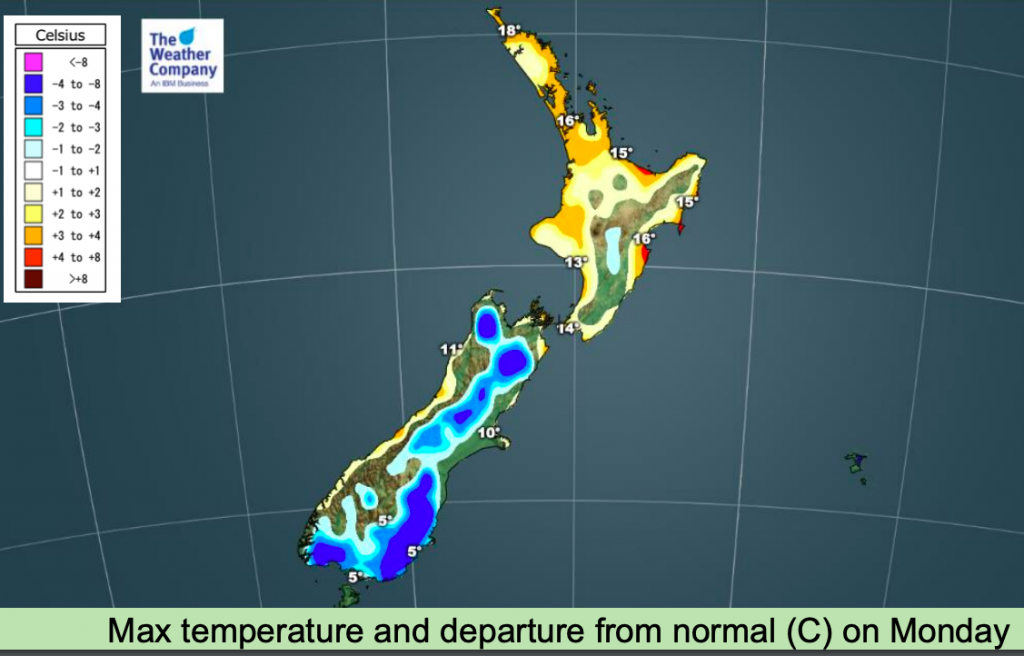
Developing —- Warmer than average weather this weekend will be the precursor to a dramatic temperature drop next week as a southerly blast moves in with polar connections.
Temperatures will plummet in the South Island on Monday, especially Southland, Fiordland and Otago, with a much colder Tuesday and Wednesday on the way for northern NZ.
Snow will likely impact southern highways and potentially State Highway One, the Desert Road, in Central Plateau.
Snow levels in the lower South Island haven’t been locked in yet, but “low level” usually means 100 to 200m with some flurries potentially even going to sea level (but unlikely accumulating to much or settling for long at that level).
Stormy weekend in some places:
• A high pressure off the north of the North Island and a trough of low pressure over Tasman Sea will both work to produce a strong northwesterly wind to New Zealand for the next couple of days. This wind will transport very heavy rain on the West Coast. Daily rainfall of
100-150mm or more will locally occur across the West Coast and Fiordland on Friday.
• Heavy rain area will lift northward into the North Island through this weekend. Western facing portions of the North Island such as
Taranaki, Manawatu-Wanganui and Wellington will receive 50-80mm of rainfall this weekend.
• Northwesterly winds increase strength through Cook Strait on Friday reaching 90-100km gusts.
• The trough now locating over Tasman Sea will pass over New Zealand from Sunday to Tuesday, bringing widespread rain and
then snow higher up across the country. Snowfall amounts will reach 20-30cm from this weekend to early next week across high elevation areas
of the South Island. Even the North Island will see light snowfall.
• Behind the trough strong southwesterly winds will impact the eastern coast of the South Island early next week.
• Temperatures will drop notably from Sunday to Monday as wind direction changes from northwest to southwest.


Latest Video

NZ: 8 Day outlook as gales & rain ease, high pressure builds
Damaging wind gusts and heavy rain will continue to affect some parts of the North Island and brushing Marlborough today…
Related Articles
NZ: 8 Day outlook as gales & rain ease, high pressure builds
Damaging wind gusts and heavy rain will continue to affect some parts of the North Island and brushing Marlborough today…

Pockets of hit & miss heavy rain, snow moves northwards
Low pressure continues to slowly move across the upper North Island and for some that will bring the sun out,…

Slow go for northern low & southern cold
For the next few days low pressure will crawl over the upper North Island, driving in rain as far south…

