
Polar southerly Sat-Mon, northern low then high pressure grows next week
14/08/2026 12:27pm
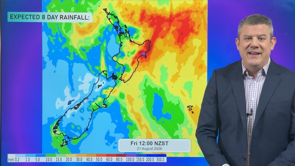
Low pressure over the top of the country will continue to produce pockets of heavy rain around Northland, but especially around parts of BOP, East Cape, Gisborne and Hawke’s Bay going into the weekend.
The polar southerly arrives in the Deep South tonight/overnight, moving up the South Island across Saturday and then into the North Island on Sunday – with it nationwide for a time later Sunday and into Monday.
But next week a mountain of high pressure exits the Tasmania region and moves closer to NZ – encouraging more southerly winds, although not quite as cold as the weekend burst, and drier weather generally increasing as the high inches closer towards us.
We also have an 8 day rainfall map covering all the showers/rain and which areas are dry or mainly dry.
Latest Video
Snow, gales, frosts and sunshine as spring kicks in
Temperatures will lift up on Saturday ahead of Sunday’s polar change, with Sunday seeing the potential for snow down to…
Related Articles
High pressure flirts with NZ this week
Monday is another windy and colder day for a number of regions, but high pressure will try this week to…
Snow, gales, frosts and sunshine as spring kicks in
Temperatures will lift up on Saturday ahead of Sunday’s polar change, with Sunday seeing the potential for snow down to…
Polar snap Sunday, high pressure next week finally
Cold air will linger over NZ for another 24 to 36 hours, bringing more frosts and low temperatures tonight, but…

