Weather headlines (x3) for Wednesday: Strong winds today, Thunderstorms in the west, Southwesterlies on Friday
31/05/2022 7:00pm
> From the WeatherWatch archives
Here’s what is making the weather headlines today.
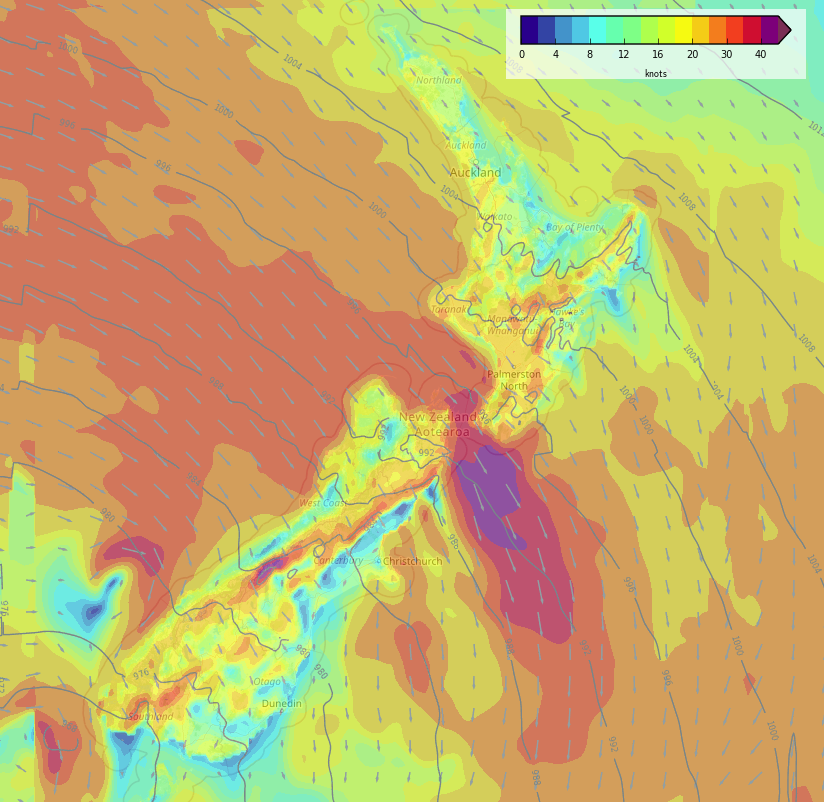
STRONG WINDS FOR THE START OF WINTER
The airflow over New Zealand today is strong from the north or northwest, coastal parts in the west of both Islands will likely experience strong winds.
Winds will likely be strongest through central areas especially Cook Strait with gales. Banks Peninsula northwards in the east may see gusty northerly quarter winds today too.
Check out the weather warnings today from Metservice here.
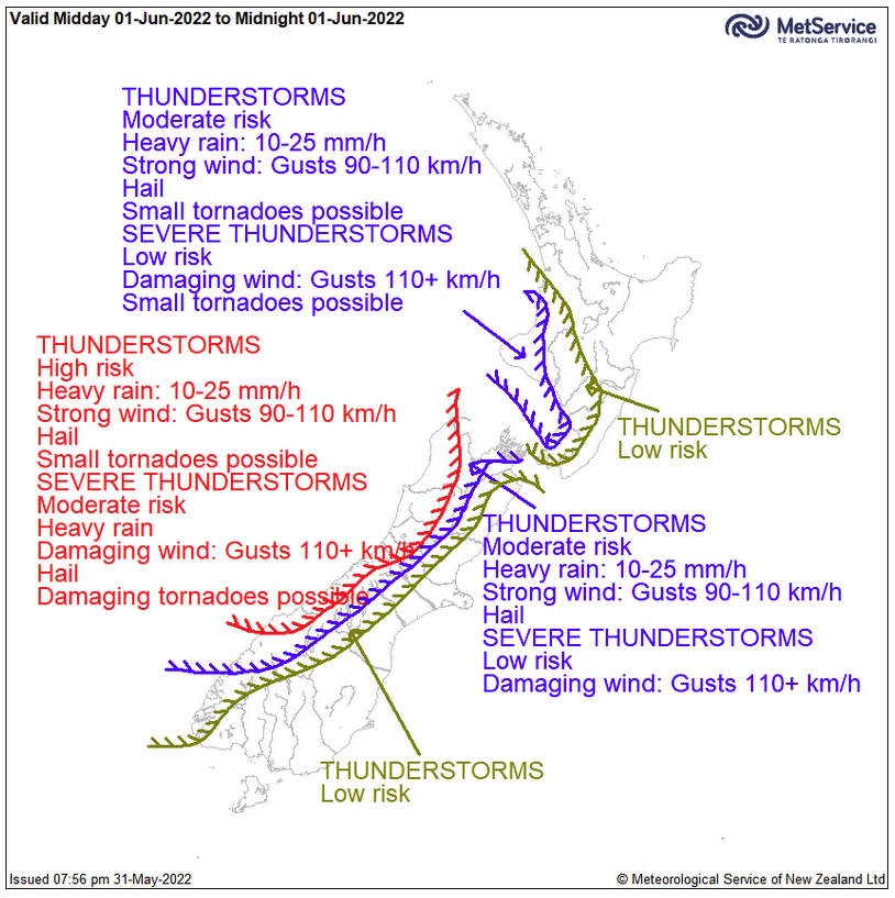
THUNDERSTORMS TODAY IN THE WEST
Cold upper air and some forcing either through a front moving through or air being pushed up by mountain ranges causes some instability today. The West Coast of the South Island has the biggest risk of storms but the southwestern corner of the North Island holds a risk of storms too.
Thursday holds a risk of storms for western regions again then the next risk appears around Tuesday or Wednesday next week. More on the thunderstorm risk from Metservice here.
SOUTHWESTERLIES MOVE IN LATE THURSDAY / FRIDAY
Southwesterlies push in over the South Island overnight Thursday then moving northwards during Friday and getting into the North Island. Showers will push up the east coast of the South Island however there isn’t a heck of a lot in it precipitation wise, as southerlies push into the lower North Island Friday afternoon expect some rain with a chance of heavy falls, moving into Hawkes Bay and Gisborne in the evening.
A high moves in on Saturday with settled weather likely.

Friday 3pm 
Saturday 3pm
Latest Video

Cold weekend, frosts return with high pressure, then a low late next week
The subantarctic airflow spreads over NZ today/tonight and into Saturday, dropping temperatures nationwide. Snow flurries are possible today to lower…
Related Articles
Cold weekend, frosts return with high pressure, then a low late next week
The subantarctic airflow spreads over NZ today/tonight and into Saturday, dropping temperatures nationwide. Snow flurries are possible today to lower…

Wintry burst of weather: Snow, squally showers then sunshine & frosts
A polar change (another one!) arrives on Friday for the South Island and goes nationwide on Saturday, leaving NZ under…

Antarctic southerly for parts of NZ Fri & Sat
For the first time this year a southerly from off Antarctica is heading towards the South Island, followed by more…

