Weather headlines (x3) for Tuesday: Rain eastern North Island eases, Frost risk overnight, Strong winds Cook Strait
9/05/2022 7:00pm

> From the WeatherWatch archives
Here’s what is making the weather headlines today.
RAIN EASES THIS AFTERNOON EASTERN NORTH ISLAND
Some rain pushing through for the eastern North Island may be heavy this morning but it eases from midday starting in the south. Winds are fresh from the south.
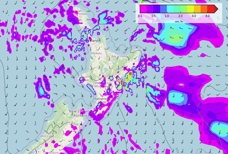
Tuesday 9am 
Wednesday midnight
FROST RISK OVERNIGHT
Yes to reiterate a frost risk is present overnight for the South Island especially for inland areas, not a heavy frost but -1 to -2 may occur in sheltered spots like the Mackenzie Country and alpine areas of the upper South Island. Further north just the Central Plateau presents a risk of frosts tonight. More on frosts here.
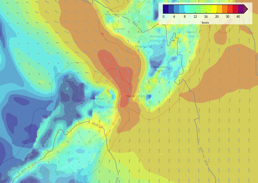
STRONG SOUTHERLIES THROUGH COOK STRAIT TODAY
Winds through Cook Strait today will be strong from the south, and they will be the strongest winds for most of this week. With high pressure moving in from Wednesday and hanging around till at least Saturday we can be sure of light winds for most.
Latest Video

Slow go for northern low & southern cold
For the next few days low pressure will crawl over the upper North Island, driving in rain as far south…
Related Articles
Slow go for northern low & southern cold
For the next few days low pressure will crawl over the upper North Island, driving in rain as far south…

Slow moving low to track over northern NZ
A low pressure zone will slowly cross the North Island over the coming days, bringing hit and miss pockets of…

NI low pressure, SI polar change
Low pressure will move over the upper North Island this week, bringing hit and miss pockets of heavier rain into…

