Weather headlines (x3) for Thursday: Isolated thunderstorm potential today, New low on Saturday, Rain outlook
27/07/2022 7:00pm

> From the WeatherWatch archives
Here’s what is making the weather headlines today.
THUNDERSTORM POTENTIALLY WESTERN NORTH ISLAND
A series of cold fronts pass over the North Island coming out of the Tasman Sea today. With these fronts brings the chance of some heavy rain and isolated thunderstorms – but also long dry spells.
The western and upper North Island has a chance of thunderstorms with Taranaki, Northland, Great Barrier Island, Coromandel and eastern Bay Of Plenty being higher risk than elsewhere.
Check out the thunderstorm outlooks from Metservice here.

T/S Risk – Thursday Morning 
T/S Risk – Thursday Afternoon
NEW LOW MOVES IN ON SATURDAY
A low moves out of the Tasman Sea on Saturday pushing over central New Zealand, there is the potential for some heavy rain for central New Zealand as this moves through. Overnight the low passes away to the southeast.
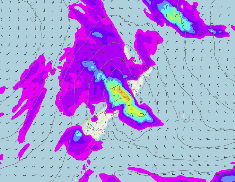
MSLP / Rain map – Saturday 30th July 3:00pm 2022 
MSLP / Rain map – Sunday 31st July 3:00am 2022
HOWS THE RAIN OUTLOOK LOOKING?
Conditions are still looking average to wetter than average for most regions around the country over the next seven days, but there are some positives here, eastern regions especially Canterbury are looking drier than normal. This is good as Canterbury is certainly water logged at the moment so some drier weather here is a good thing.
Latest Video

Frosts, late week rain & another cold weekend coming
High pressure will cross NZ over the next few days meaning more cold nights/mornings with frosts, but a nor’wester will…
Related Articles
Frosts, late week rain & another cold weekend coming
High pressure will cross NZ over the next few days meaning more cold nights/mornings with frosts, but a nor’wester will…

NZ: Cold & windy, then calm & frosty
Downpours, some squally with the chance of thunderstorms and even small tornadoes are possible for parts of NZ over Friday…

WeatherWatch App launches real-time local lightning tracker
A bolt out of the blue! WeatherWatch has launched a live, real-time lightning tracker, enabling Kiwis to gain access to data provided by the…

