
Frosts, late week rain & another cold weekend coming
27/07/2026 2:28pm
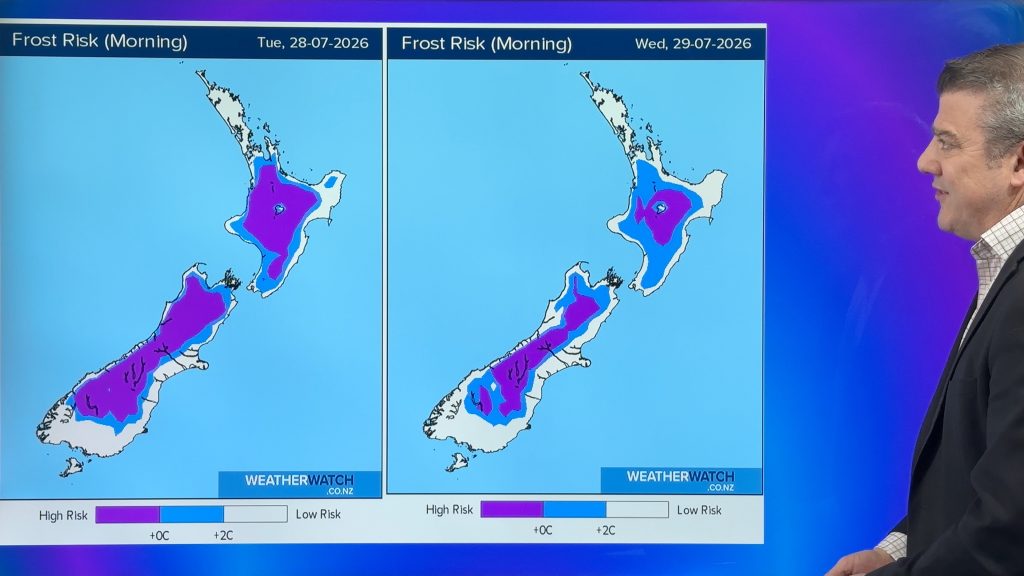
High pressure will cross NZ over the next few days meaning more cold nights/mornings with frosts, but a nor’wester will develop and spread up the country mid to late week, ending/limiting frosts for a time and dragging in more cloud with showers and rain. Some of this will turn to snow from Thursday night in the South Island and into the North Island’s mountains and ranges going into Friday and the weekend.
By Saturday the polar boundary will be well north of NZ, bringing colder weather and showers (and snow flurries higher up) across both main islands, and a burst of wintry weather for the eastern side of the country (Otago northwards) with rain, sleet, snow and cold south to south-east winds.
Winter is certainly wintering!
Latest Video
Cold front heads north, high pressure struggles to reach NZ
A burst of colder air spreads over NZ tonight but for many places Friday will be a milder day as…
Related Articles
Cold front heads north, high pressure struggles to reach NZ
A burst of colder air spreads over NZ tonight but for many places Friday will be a milder day as…
Thursday’s cold front, then more westerlies on way
A cold front will spread over the South Island by noon tomorrow, then over the North Island by midnight tomorrow,…
NZ: Burst of polar air coming, frosts expand
Low pressure is today leaving the North Island to the east, and behind it we’re on the edge of weather…

