VIDEO: Tracking Thursday’s severe gales + Labour Weekend weather
22/10/2025 11:35pm
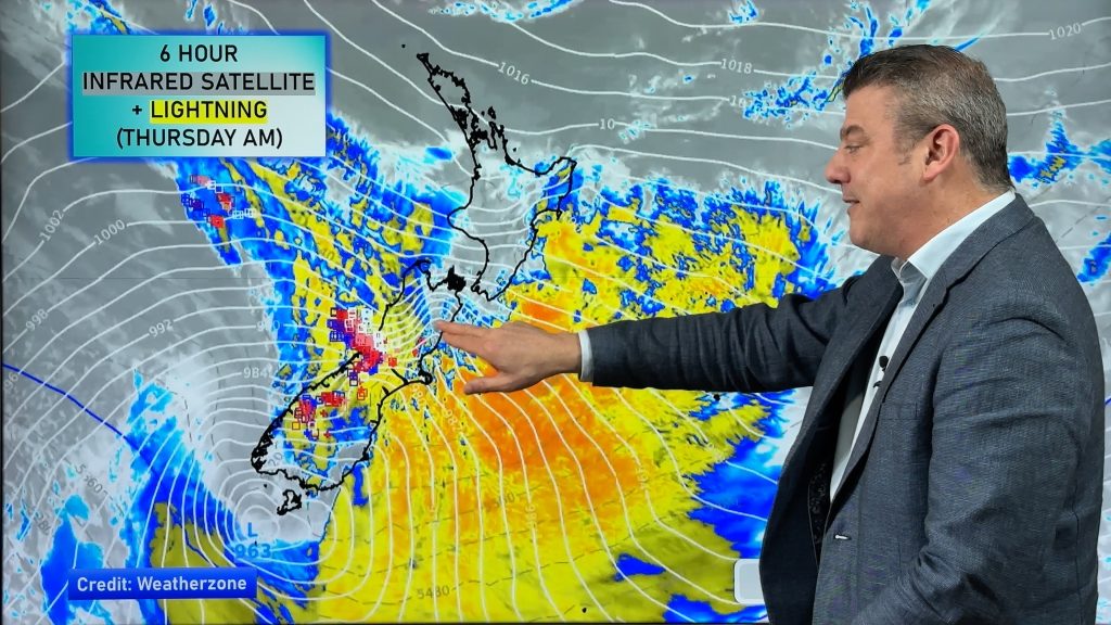
Severe gales (reaching hurricane force in places with gusts over 220km/h this morning in exposed parts of Marlborough) will blow through across Thursday in a number of regions as a deep low pressure system tracks past Stewart Island.
Heavy rain and thunderstorms spread up the West Coast while damaging winds are possible across parts of the South Island and lower North Island. The good news is that the worst of these winds should ease tonight. Keep up to date with MetService warnings and watches.
The long weekend forecast is a bit messy – but still some dry, sunny, weather for a number of places. But some areas won’t shake those windy westerlies – with another surge coming in on Sunday and Monday, and again Tuesday.
We break it all down for you.
Latest Video

Polar airflows set to bring cold weekend to NZ
Nor-west winds will be building over parts of NZ going into Thursday with rain on the West Coast becoming heavy…
Related Articles

WeatherWatch App launches real-time local lightning tracker
A bolt out of the blue! WeatherWatch has launched a live, real-time lightning tracker, enabling Kiwis to gain access to data provided by the…

Wind, rain, showers & a noticeable temperature drop for all
It will be a colder weekend right across NZ as a sub-Antarctic southerly blows through, bringing frosts, snow flurries and…
Polar airflows set to bring cold weekend to NZ
Nor-west winds will be building over parts of NZ going into Thursday with rain on the West Coast becoming heavy…

