VIDEO: NZ milder with downpours + the Melbourne storm
5/09/2023 12:04am

> From the WeatherWatch archives
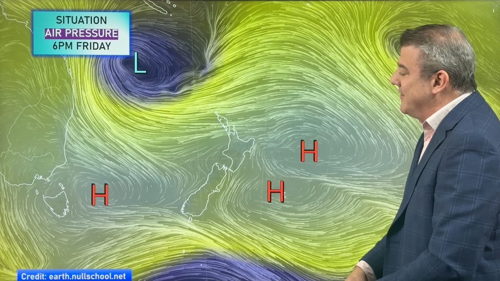
It’s quite an unsettled weather pattern from Perth to Adelaide, Melbourne to New Zealand as spring-like weather from the Southern Ocean pushes through active cold fronts and lows.
With some large high pressure zones around too, it means a fair amount of variety for both NZ and Australia in the days ahead – while the tropics have a bit of a breather from recent rain – Fiji is mostly dry in the several days ahead.
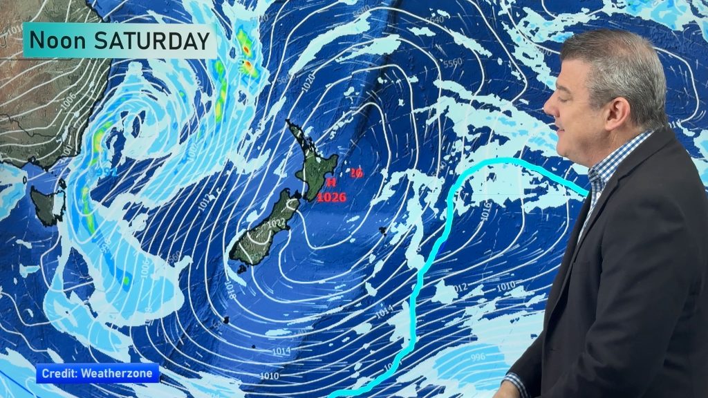
NZ has generally mild weather coming in with northerlies and westerlies dominating – that will push some eastern places into the low 20s temperature-wise. Heaviest rain in NZ will be on the West Coast with up to 150mm possible in the 48 hours from 7pm tonight (Tuesday).
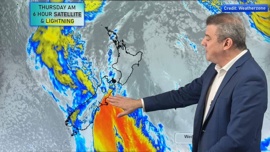
Australia is quite dry inland – but those towards the south coast have plenty of active weather with thunderstorms, squalls and gales over the next week. A deep low will form around Victoria later this week bringing some stormy weather to Melbourne and even Adelaide, Canberra, Sydney and Hobart all get caught up in it for a time.
We have your forecast for NZ and Australia for the rest of this week and the upcoming weekend.
Comments
Latest Video
Your NZ forecast through to King’s Birthday Monday
High pressure continues to control NZ’s weather but a change to wet weather and low pressure is expected during the…
Related Articles
Your NZ forecast through to King’s Birthday Monday
High pressure continues to control NZ’s weather but a change to wet weather and low pressure is expected during the…
A few showers, but still a lot of high pressure
Showers continue in parts of NZ going into the weekend and through next week, we track them for you –…
High pressure still in charge, but a few changes in the mix
High pressure continues to control much of New Zealand’s weather although there will be some wind and temperature changes in…


Roderick on 5/09/2023 7:09am
Why is it that time and time again over the past two years we have a blocking high sitting to the east of NZ halting successive low pressure zones from moving, then stalling and funnelling tropical moist saturated air directly into Northern NZ? Often stalling for a week or more. Is this a new phenomenon, or something which is becoming the new normal? If it is a new phenomenon, is it due to climate change and can we expect more frequent atmospheric rivers from the northeast? Will El Niño defer this possibility? Is there any possibility that we will have a blocking low east of NZ to allow a long period of settled weather?