Updated Maps (x17): Long weekend weather highlights
22/10/2021 11:36pm

> From the WeatherWatch archives
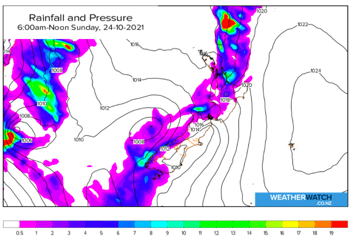
Easterlies gusting to gale force are still impacting the upper North Island as rain starts to head southwards down Northland and towards Auckland later today/tonight.
Air pressure is quite high in the north so rainfall is likely to be fairly patchy as it moves southwards – but some parts of Northland may have slow moving heavy falls in the east, around the Bay of Islands in particular. Rainfall totals may exceed 80mm and go up to 120mm. But the totals drop right off as it heads southwards through the Auckland region.
Gales extend down to Auckland city but are mainly below damaging. The odd isolated branch may came down so people should take care outdoors near trees in the most exposed areas. Gales are also expected to continue at times along the eastern Waikato/western side of the Kaimai and Coromandel Ranges. Winds will slowly taper back on Sunday and ease further on Monday.
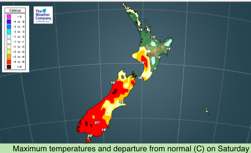
The southern ends of both islands are leaning warmer than normal today and Sunday (and in fact for many across next week too). The lower South Island is in the low 20s as we go through the lunch hour, several degrees above average for Labour Weekend.


YOU MAY ALSO BE INTERESTED IN
Latest Video

Rain & showers this weekend, colder change next week
Some places will warm up over the next day or so as a nor’wester out of Australia moves across NZ,…
Related Articles
Rain & showers this weekend, colder change next week
Some places will warm up over the next day or so as a nor’wester out of Australia moves across NZ,…

Temperature changes for some regions ahead of heavy West Coast rain
A nor-wester is about to kick in and it’s coming from out of Australia, boosting temperatures in some regions going…

NZ 7 day forecast: Showers, temp changes and heavy West Coast rain
NZ has a fairly messy forecast over the next 7 days, but the main feature will be heavy rain on…

