Eastern cloud/showers for the NI, high pressure expands elsewhere
14/05/2026 12:03am
A colder south to south-east flow will keep clouds and showers moving into some eastern parts of the North Island over the next several days, although inland areas may be sunnier and drier – and certainly those west of the main ranges have clearer skies.
The South Island is the most settled with high pressure moving in over the coming days, with more frosts and fog patches and mainly dry weather.
There is little change to the forecast over the next several days but some areas may notice and improvement while others may get more cloud going into next week.
Latest Video

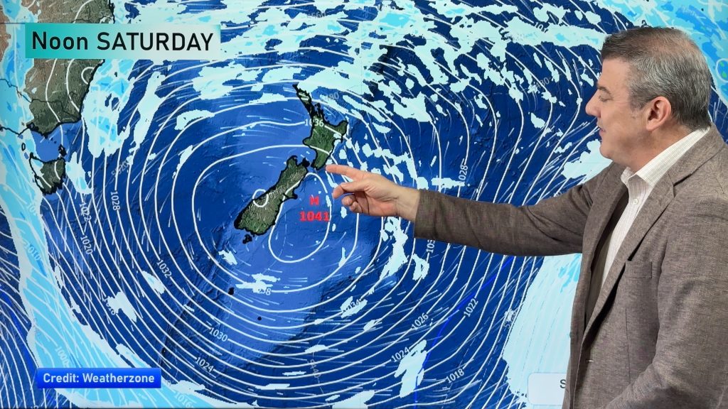
NZ: 8 Day outlook as gales & rain ease, high pressure builds
Damaging wind gusts and heavy rain will continue to affect some parts of the North Island and brushing Marlborough today…
Related Articles
NZ: 8 Day outlook as gales & rain ease, high pressure builds
Damaging wind gusts and heavy rain will continue to affect some parts of the North Island and brushing Marlborough today…

Pockets of hit & miss heavy rain, snow moves northwards
Low pressure continues to slowly move across the upper North Island and for some that will bring the sun out,…

Slow go for northern low & southern cold
For the next few days low pressure will crawl over the upper North Island, driving in rain as far south…

