Southern Ocean storm intensifies, to briefly drift away before returning (+5 Maps)
3/12/2019 9:45pm

> From the WeatherWatch archives
The huge storm in the Southern Ocean near New Zealand and Tasmania will continue to deepen and intensify over the next 24 hours – but oddly in NZ our weather will ease a bit in most regions for a time. It’s a bit of one step forwards one step backwards for the storm which will drift westwards back away from us over the next day or so, before moving back in. It’s only a slight shift but it’s one that has consequences with a reduction in severe weather – for a time.
This means most of the North Island is really on the outside of this event with just a little bit of wind at times for Wellington and it’s unlikely to be as bad as it was on Tuesday.
RAIN
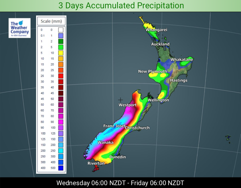
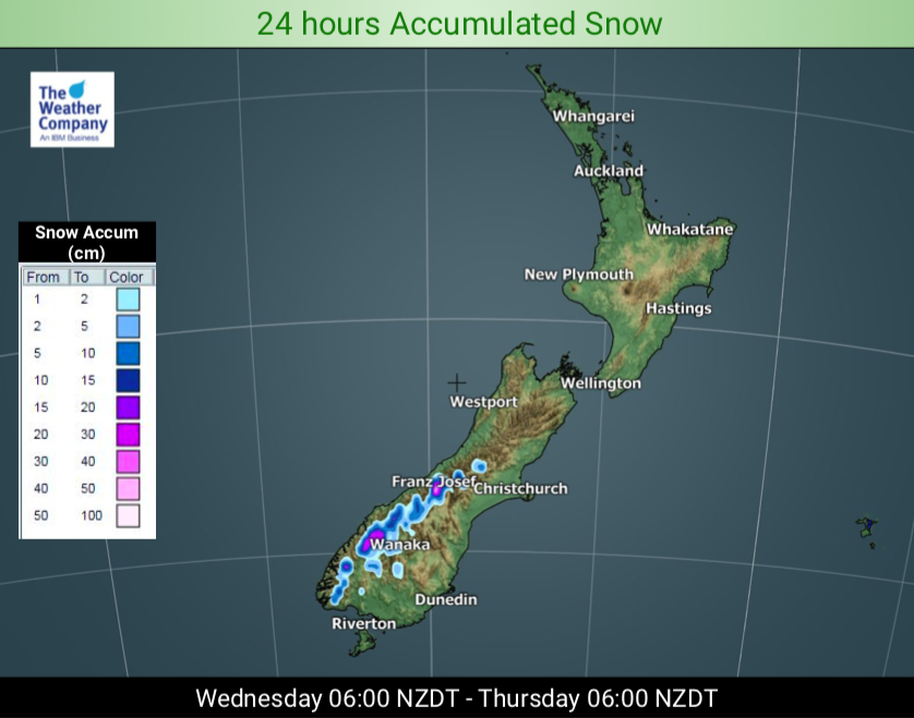
Rain on the West Coast won’t be leaving – but eases a little in the north today for a time and on Thursday afternoon it will be more broken up with dry spells, even some sunny spells may return to the main centres like Westport and Greymouth. Make the most of it – a huge amount of rain is still yet to come.
Don’t be fooled by the lull as the storm drifts a little further away for a time – because it drifts back on Friday and this weekend it finally crosses NZ. This action will push heavy rain back into the West Coast on Friday, Saturday and Sunday and incredibly another 300 to 400mm possible over the next few days. Watch for slips and flooding there. There will also be some spillover rain again into very western Southland, Otago, Canterbury and Nelson.
WIND:
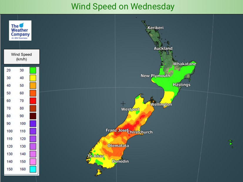
With the low still intensifying winds are still gaining strength around the storm’s centre – but the storm is also drifting a little away from NZ for the next day or two which mean winds speeds will be much lower over the North Island and strongest winds will become more confined to the Southern Alps and parts of inland Canterbury. Cook Strait remains a likely wind tunnel – but not as bad as Tuesday was.
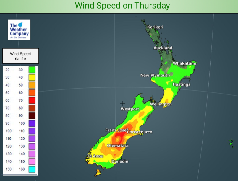
With the low intensifying a little today we can expect winds to be blustery over the South Island still, but on Thursday both wind and rain do ease back.
On Friday this low weakens further – so becomes less intense overall – but because the centre of the low is then moving in to the NZ area directly, we can expect winds to increase nationwide and rain to move in.
The storm weakens end of this week, the low moves in this weekend, then on Monday it clears away. There will be a colder/cooler change that sweeps over NZ on Sunday and Monday with a burst of rain and/or wind – but as early as next Tuesday subtropical airflows may be returning again.

– WeatherWatch.co.nz
Latest Video

Antarctic southerly for parts of NZ Fri & Sat
For the first time this year a southerly from off Antarctica is heading towards the South Island, followed by more…
Related Articles
Antarctic southerly for parts of NZ Fri & Sat
For the first time this year a southerly from off Antarctica is heading towards the South Island, followed by more…

Meteors – Your Eyewitness Reports!
WeatherWatch.co.nz receives meteor reports from all over New Zealand and the globe, 24/7/365. **CASUAL COMMENTS**If you’ve seen something in the…

Snow, rain showers & cold polar southerlies set to return
Friday will be a wintry day across NZ as the next cold front arrives, bringing snow to lower levels of…

