NZ: Brief southern polar airflow coming, but the subtropics visit next week!
12/11/2025 11:01pm
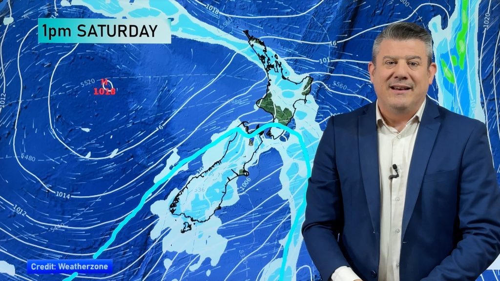
Low pressure is dropping southwards today, over the South Island leaving some heavy showers in its wake for the upper North Island.
A short lived cold snap will spread up the South Island on Friday PM (or overnight) and into Saturday – before clearing most places by Saturday night. It will bring lower morning temperatures to both islands over the weekend, but by next week the subtropical airflow returns thanks to a huge and strong anticyclone east of the country. This will scoop mild air from Rarotonga and Tonga and drag it down over most of the country for a time.
But the weather pattern remains messy, with plenty of showers coming into the nation over the next week – along with some large dry areas.
Despite the brief cold change, most places will likely be warmer than average for this time of year over the coming 7 days due to the prolonged northerly or subtropical flow.
Comments
Latest Video

Wintry weather coming: Snow, rain, wind & sunshine
A cold front is moving into NZ from Friday to Sunday with low pressure developing west of NZ and then…
Related Articles

Polar airflow + northern low = pockets of heavy rain & snow
A colder change is coming – and so too is a large low which will develop and grow over northern…
Wintry weather coming: Snow, rain, wind & sunshine
A cold front is moving into NZ from Friday to Sunday with low pressure developing west of NZ and then…

ClimateWatch: JULY outlook & what El Niño means for NZ
El Niño is officially here and still getting stronger in the months ahead, but it’s harder to notice its effects…


Rorie Kearse on 13/11/2025 8:45am
Any chance of a cyclone coming our way in mid 2025 – 2026
WW Forecast Team on 13/11/2025 7:26pm
Hi Rorie, each year NZ has some risk of a tropical cyclone reaching us. With La Nina trying to form we may see more low pressure north of NZ over the next couple of months, so worth monitoring. At this stage no areas of interest, other than one low pressure zone to the north-west of Australia (outside our risk zone).
Cheers
WW