Monday’s national forecast – Hotter weather builds again (+11 Maps)
24/01/2021 3:00pm

> From the WeatherWatch archives
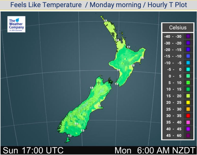
It’s going to be hotter and a bit windy as we kick off this week, with high pressure centred just north west of New Zealand.
This set up is helping bring in a pulse of Australian heat this week and temperatures are likely to surge into the mid 30s for some eastern/inland parts of the South Island and potentially the North Island too.
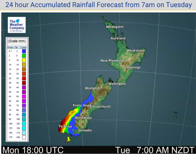
Rain is limited today to the south western corner of the South Island, mostly Fiordland and South Westland with a few isolated showers in Southland and also further up the West Coast. The North Island is dry today.
Westerlies will still be a bit windy today with much of the country on the outer edges of the northern high pressure system although in the north of NZ it will be fairly calm.
This set up encourages hotter conditions with west to north west winds moving in, meaning eastern and northern NZ will be sunniest too.


Latest Video

Antarctic southerly for parts of NZ Fri & Sat
For the first time this year a southerly from off Antarctica is heading towards the South Island, followed by more…
Related Articles
Antarctic southerly for parts of NZ Fri & Sat
For the first time this year a southerly from off Antarctica is heading towards the South Island, followed by more…

Meteors – Your Eyewitness Reports!
WeatherWatch.co.nz receives meteor reports from all over New Zealand and the globe, 24/7/365. **CASUAL COMMENTS**If you’ve seen something in the…

Snow, rain showers & cold polar southerlies set to return
Friday will be a wintry day across NZ as the next cold front arrives, bringing snow to lower levels of…

