Monday update: East coast storm continues, but a brighter forecast for many this weekend
15/02/2026 11:12pm
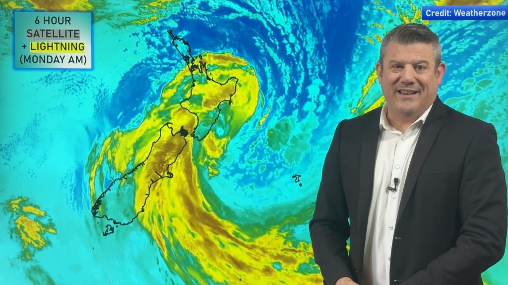
Severe weather continues today in the southern half of the North Island and some eastern parts of the South Island, as far south as coastal Otago, as a large storm churns off the eastern side of the lower North Island. Over the next 24 hours this low will start to weaken and sink southwards – which is why southern eastern parts of the South Island have some severe weather risks.
By Wednesday the storm is not only gone from NZ, but the low itself falls apart south-east of the nation – but behind it is another storm, this one will come close to East Cape but – for now – we don’t expect severe weather there. But the Chatham Islands may get a direct hit from it, with damaging winds expected for a time.
By Thursday that storm is also gone – and high pressure over the Tasman Sea is trying to move in. This means mid to late this week many places worst hit by the current storm will have drier weather and lighter winds. Showers are most likely in the south and west of NZ for Thursday and Friday.
This weekend high pressure is likely over the North Island and upper South Island and mild westerlies in southern NZ.
Comments
Latest Video

Wintry weather coming: Snow, rain, wind & sunshine
A cold front is moving into NZ from Friday to Sunday with low pressure developing west of NZ and then…
Related Articles

Polar airflow + northern low = pockets of heavy rain & snow
A colder change is coming – and so too is a large low which will develop and grow over northern…
Wintry weather coming: Snow, rain, wind & sunshine
A cold front is moving into NZ from Friday to Sunday with low pressure developing west of NZ and then…

ClimateWatch: JULY outlook & what El Niño means for NZ
El Niño is officially here and still getting stronger in the months ahead, but it’s harder to notice its effects…


Andrew on 16/02/2026 6:00am
You do a great job!
Just wondering where you would ideally choose to live in NZ for the best weather?
I understand there is a seasonal and annual change but interested in your thoughts.
regards Andrew
WW Forecast Team on 16/02/2026 8:48pm
Hi Andrew, thanks for the kind support. Tough question to answer though, as it depends on your definition of “best weather”. If you like it dry – Central Otago is almost technically a desert due to low annual rainfall. If you like rain, the West Coast is for you. If you love wind, Wellington and Wairarapa can bring you that. If you love it calm, head to King Country. If you prefer sun, Bay of Plenty, Nelson and Marlborough can help you there. If you like warmth, head to Northland. And if you like a good mix of it all, Bay of Plenty is for you. Most NZ regions have a good variety of weather, but generally eastern areas are drier, western areas wetter/cloudier, the far north is more subtropical, the deep south is more subantarctic.
Cheers 🙂
– WW