Large low to rapidly form this week
30/11/2025 11:11pm
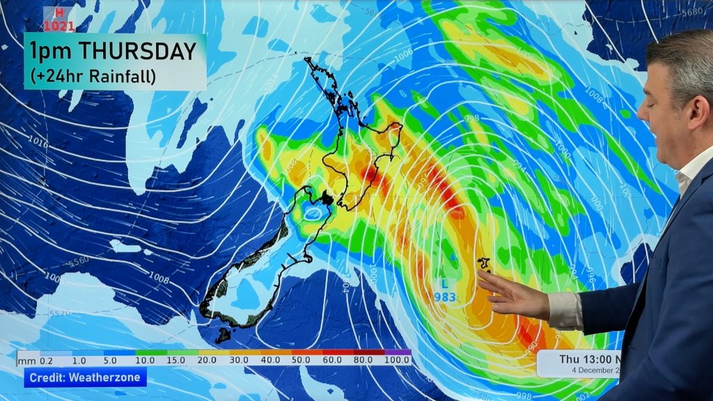
The first of Summer on the meteorological calendar is fairly settled around NZ, cool in the very south, warm in the very north – but the main energy comes in on Wednesday and Thursday as a low from the Tasman Sea rapidly forms and grows and crosses the country with a burst of wind and rain.
How much rain and where it falls continues to be fine tuned – and we’ll have more details in Tuesday’s update, but we take a look at the latest forecasts.
Later in the week warmer/hotter airflows return with high pressure also in the mix.
In the very south of the South Island the polar boundary comes and goes bringing some cooler days, especially to kick off this week.
Latest Video

Update on incoming cold change for NZ
High pressure still covers NZ but that will slide offshore as we go into Friday and the weekend as a…
Related Articles
Update on incoming cold change for NZ
High pressure still covers NZ but that will slide offshore as we go into Friday and the weekend as a…

Wintry blast coming this weekend, everyone will feel the temperature drop
A significant cold change is coming in this weekend, starting as early as Friday for the lower South Island and…

Tracking the showers & a potential wintry blast late next week
NZ is on the edge of high pressure with anticyclones moving through at times over the next several days bringing…

