Large low incoming: Rain, gales, thunderstorms and instability
1/12/2025 11:15pm
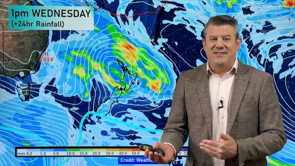
Areas of rain, thunderstorms, and instability will be crossing NZ over the next 48 hours, with some heavy rain around the North Island, although our mountains and ranges may break that into patchy or more showery weather for others. Low pressure can be notoriously unpredictable.
Thunderstorms and instability can break rainfall forecasts – especially when a large low pressure system is moving in – producing heavier falls than expected in some areas, especially if slow moving. This is especially true for the northern and eastern sides of the North Island over the next couple of days. One positive is that very dry eastern areas of both main islands may get the rain relief they have been wanting for a while now.
Severe thunderstorms are also possible – these don’t always have to have thunder and lightning, it’s all about the large type of cloud build-up, and these can create very heavy slow moving rain.
Expect the unexpected over the next 48 hours due to this instability.
We also track the gales, which ramp up especially on Thursday around the North Island and upper South Island.
Plus, Phil has your weekend forecast and outlook for next Monday.
Latest Video

Polar airflows set to bring cold weekend to NZ
Nor-west winds will be building over parts of NZ going into Thursday with rain on the West Coast becoming heavy…
Related Articles

Wind, rain, showers & a noticeable temperature drop for all
It will be a colder weekend right across NZ as a sub-Antarctic southerly blows through, bringing frosts, snow flurries and…
Polar airflows set to bring cold weekend to NZ
Nor-west winds will be building over parts of NZ going into Thursday with rain on the West Coast becoming heavy…

Update on incoming cold change for NZ
High pressure still covers NZ but that will slide offshore as we go into Friday and the weekend as a…

