
Hotter, but Wintry Snap coming late week
11/10/2026 4:54pm
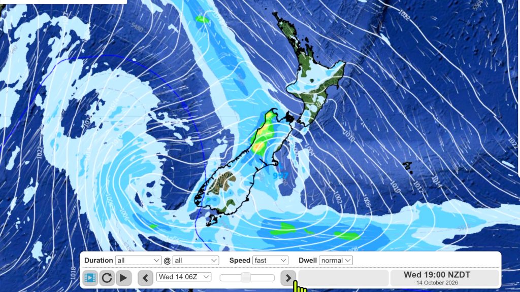
Temperatures will soar into the mid to late 20s early week but single digits for some by late week as a wintry snap comes in, bringing snow to the mountains and ranges, wind chill for newborn lambs and a spring like temperature change.
A warm to hot nor’wester continues for the rest of Sunday, Monday and Tuesday for most places, then the southerly arrives in the south over Wednesday/Thursday and into the North Island late week. Some places in the South Island will have more than 12 to 14 degrees wiped off their maximums, bringing single digits highs in some places for a time.
But by next weekend a powerful anticyclone (high) is exiting Tasmania and likely bringing a settled weekend – there may also be a return of some frosts by Friday/Saturday.
PROGRAMMING NOTES:
- Phil is offscreen next couple of weeks with family, but will still be doing video updates (but timings will likely change a bit). The format will be different and sorry about that for those who like the usual set-up, but is the only way we can still produce updates while not using our usual studio. Will try to make improvements along the way – let us know in the comments!
- We have no video update on Monday (hence today’s update) – our next update will be on Tuesday afternoon, or possibly not until evening.
Latest Video
Hotter, but Wintry Snap coming late week
Temperatures will soar into the mid to late 20s early week but single digits for some by late week as…
Related Articles
NZ: Instability to produce some wet weekend weather, cold change next week
Afternoon downpours will expand on Saturday with possible isolated thunderstorms as atmospheric instability (due to lower pressure zones east and…
Weekend downpours in both main islands, temps increase
Warmer air will spread over more parts of NZ this weekend but it will come with showers, some downpours and…
Downpours & showers developing, but still some large dry areas
NZ is between two lows and one big high right now, bringing different airflows into different parts of each main…

