High pressure in charge, but also monitoring a tropical low next week
4/03/2026 11:59pm
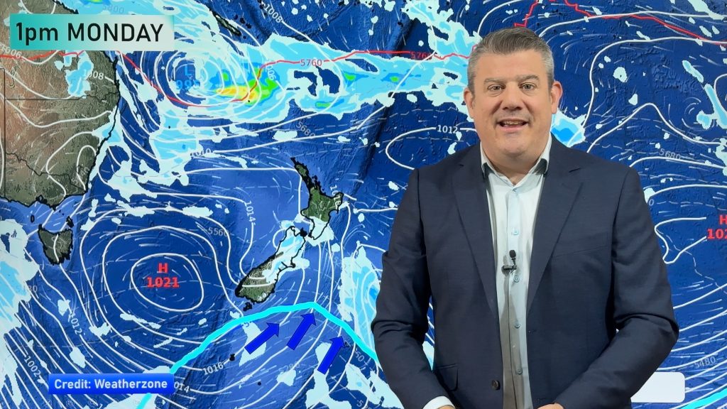
High pressure continues to dominate NZ’s weather as a tropical cyclone forms in the Coral Sea today. The cyclone, which may not even be named due to its short-lived nature up near Cairns, may end up drifting towards the upper North Island mid-next week, but high pressure in the NZ area may rip the low apart. We show you the latest tracking.
A colder change on Sunday in the South Island will move into the North Island on Monday – but isn’t looking too significant for most places, especially with high pressure still dominating much of the weather around NZ going into next week.
The tropical storm near Queensland today may well reform into a new low pressure system next week as it drifts down towards NZ – but high pressure in the NZ area may hold it away from us.
We also have a 7 day rainfall map to make sense of where any showers will likely be.
Comments
Latest Video

Polar airflows set to bring cold weekend to NZ
Nor-west winds will be building over parts of NZ going into Thursday with rain on the West Coast becoming heavy…
Related Articles

Wind, rain, showers & a noticeable temperature drop for all
It will be a colder weekend right across NZ as a sub-Antarctic southerly blows through, bringing frosts, snow flurries and…
Polar airflows set to bring cold weekend to NZ
Nor-west winds will be building over parts of NZ going into Thursday with rain on the West Coast becoming heavy…

Update on incoming cold change for NZ
High pressure still covers NZ but that will slide offshore as we go into Friday and the weekend as a…


Wazza on 5/03/2026 4:01am
Hey Phil,
Thanks for the weather update and been loving the High pressure we’ve had in Auckland for nearly a whole week!!
Also great new intro music – very upbeat and trendy!
Cheers!
Wazza!