Heavy rain, gales, thunderstorms for some – but high pressure is tracking back this week
19/04/2026 11:51pm
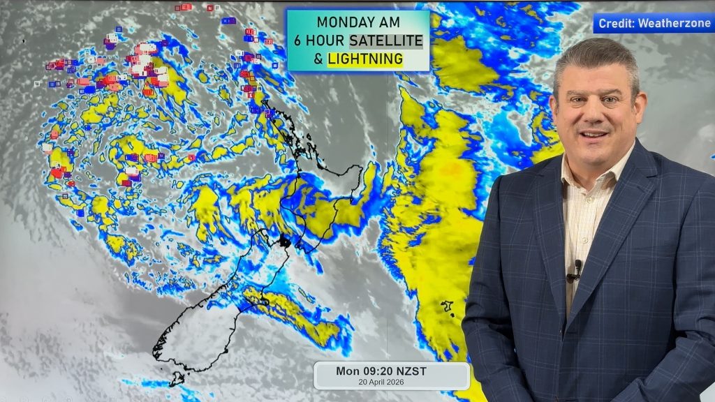
This week kicks off with a large low bringing instability and changeable forecasts, but as the low drifts over the North Island tonight it will shift the dynamic to focus on the eastern side of NZ for wet weather, with strong winds (gale around Wellington and Cook Strait) for a time too from the south and south-east.
Colder and some wet weather will also affect the eastern side of the South Island, especially the north-east corner around parts of Marlborough and Canterbury.
Those under the low pressure zone in northern NZ have light winds, and the reason for the stronger winds in central NZ is due to incoming southern high pressure creating a strong to brisk south to south-east flow over the next couple of days.
But high pressure is moving into NZ for late week and going into the weekend. We have your New Zealand forecast through to this Sunday.
Latest Video

Tracking the showers & a potential wintry blast late next week
NZ is on the edge of high pressure with anticyclones moving through at times over the next several days bringing…
Related Articles
Tracking the showers & a potential wintry blast late next week
NZ is on the edge of high pressure with anticyclones moving through at times over the next several days bringing…

Some polar airflows but more high pressure to affect NZ’s weather
Showers are in the forecast over the next several days, we track where and when they occur – but there…

Tracking the showers & colder changes
High pressure isn’t over NZ, but is nearby – and it’s affecting our airflows and who gets wet weather and…

