Ex-cyclone Fehi brings heavy rain and strong winds, more to come today (+10 Maps)
1/02/2018 2:23am

> From the WeatherWatch archives
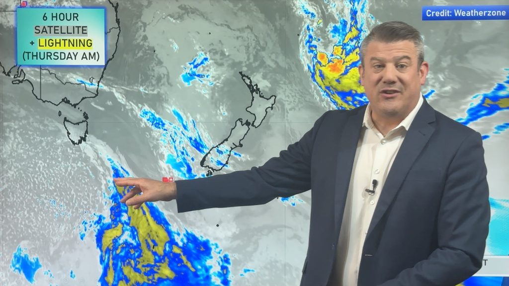
UPDATED 3:23pm — Ex-Cyclone Fehi is crossing the South Island and is morphing into a new system with two central low pressure centres. This is a sign that the storm is gradually falling apart but is so deep and tightly wound it will take until Friday AM to ease significantly.
Heavy rain with localised flooding possible is currently spreading across Auckland and Dunedin. Dunedin has the highest chance of more widespread flooding with rainfall totals over 100mm expected. Just 30mm can flood Dunedin.
As of 3:20pm Dunedin Mayor Dave Cull had declared a state of emergency for the city, with immediate effect, due to flooding. WeatherWatch.co.nz says more heavy rain is coming in the next few hours and could last until late this evening.
Central Otago forecaster James Morrison of Weatherstation says 80mm has fallen in Roxburgh, 78mm in Cromwell and 68mm in Alexandra so far – with more rain expected.
Central Otago is New Zealand’s driest region and Alexandra averages just 340mm a year so a little shy of 25% of their annual rainfall has fallen today according to WeatherWatch.co.nz.
The storm system will start to ease in the early hours of Friday.
The heavy rain in the Auckland area is now moving into Waikato and will track very very slowly eastwards tonight and across Friday morning until it clears Gisborne early Friday afternoon we believe.
The storm centre came in around Haast around 11am then split into two centres this afternoon.
EARLIER UPDATE (8am)
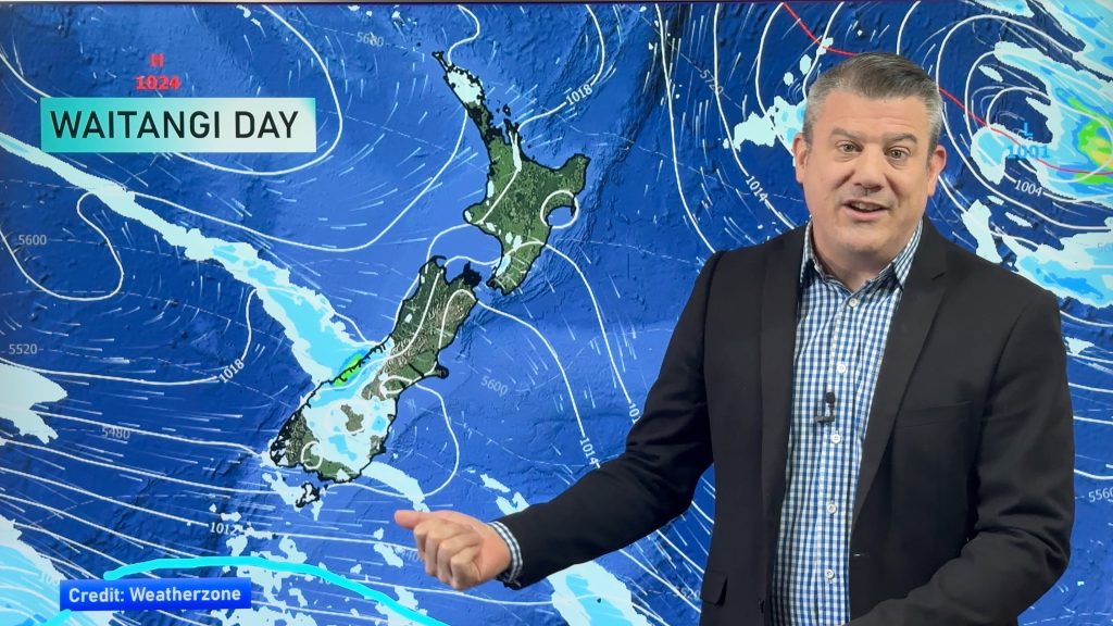
Rainfall totals are significant but with the mountains in the way and the centre of the low itself moving in you can see the rainfall totals vary a lot – especially in the Dunedin area where north of Coastal Otago the forecast totals are much lower than those west or south of the region. The storm will likely make landfall in the Haast area (generally) on the West Coast then exit around coastal Otago on the east coast later today followed by a strong, colder, southerly which could even see a dusting of snow on the ranges overnight. Temperatures will drop below zero tonight on the ski fields around Queenstown for example.
A deep trough has formed with two low pressures which are located to the north and south of the South Island.
It seems that the storm will increase its speed and move faster than the forecast yesterday which is better news for those concerned about flooding – as the faster it moves through the lower the rainfall totals may be. In saying that, the tropical nature of the rainband means flooding is still highly possible.
Meanwhile the North Island has a humid stream of northerly air today creating heavier downpours later today and overnight. Isolated flooding is possible. Gusty to gale force winds are also expected for some, mainly in the lower SW corner of the island but a few exposed northern areas too. For the most part this is a South Island storm event but some very heavy downpours are expected in the North Island and dangerous beach conditions along the western side.
Damaging winds are expected over northern coastal areas in the South Island this afternoon also amongst the mountains in various wind tunnels. It can be hard to always be specific about this when the centre moves in as wind directions then swing from the northerly quarter to the southerly quarter and that shifts the risk areas.


 ABOVE: Early afternoon rain and air pressure map. Note how the centre of the low is being stretched/elongated from the north west to the south east? This is what happens when a tropical cyclone transitions into an extra-tropical one (when it goes from having a warm tropical core to a cold centre). This process, which always occurs in the New Zealand area when a tropical storm drops south, shifts the centre away from having that perfect circular shape to this more stretched out shape. The centre is also deepening as it moves into the West Coast but the spreading out nature of the low means the energy is spread further. Image / ECMWF.


DANGEROUS SEAS/WAVES:

– Maps / The Weather Company (An IBM Business)
– WeatherWatch.co.nz (An official IBM business partner)
Comments
Before you add a new comment, take note this story was published on 1 Feb 2018.


Add new comment
Brett Spicer on 31/01/2018 9:58pm
Hi Phil & the WW Team
It’s a bit disappointing with the NZ PWS anemometer readings they all seem to read none or very low readings than what there actually is.
They must have them down low on fences etc which isn’t great, I have my anemometer on a 6 metre pole and which is also on a ridge which seems to have the highest anemometer readings in the country well fair near.
That is it for me, had my moan ha, keep up the great work.
Cheers
Brett Spicer
IHAURAKI4
Reply
Richard on 31/01/2018 9:17pm
Since the storm is expected to rapidly deepen as it closes in on the West Coast, is it expected to reach bombogenesis criteria?
Reply
WW Forecast Team on 31/01/2018 9:41pm
Hi Richard, no not that we’re aware of as it would need to drop 24hPa in 24 hours and at the moment that hasn’t happened as far as we can see.
Cheers
Philip Duncan
Reply