Drought: Drier than normal for rest of May despite large low. June kicks off with high pressure too
18/05/2020 8:03pm

> From the WeatherWatch archives
The weather this week is spectactular – it’s also harmful to dry regions. On top of the 2020 droughts we also have the 2019-2020 rainfal deficit meaning this dry Autumn will be problematic heading into winter for some people and businesses.
The next week ahead leans drier than normal for almost every part of New Zealand and the outlook to June 1 looks the same.

For Auckland the news is bad – more dry weather and just 20mm forecast over the next two weeks for the water shortage crisis. Any wet weather will likely fall as showers which means totals may be lower for some – and rainfall is not guaranteed across the catchment areas.
Other nearby farming regions like Northland and Waikato, along with rural Auckland, are also facing more dry weather and similar below average rainfall totals. Eastern leaning areas may be the driest.

One positive is that daytime temperatures are mild – but the nights are cold so pasture growth will be limited now.
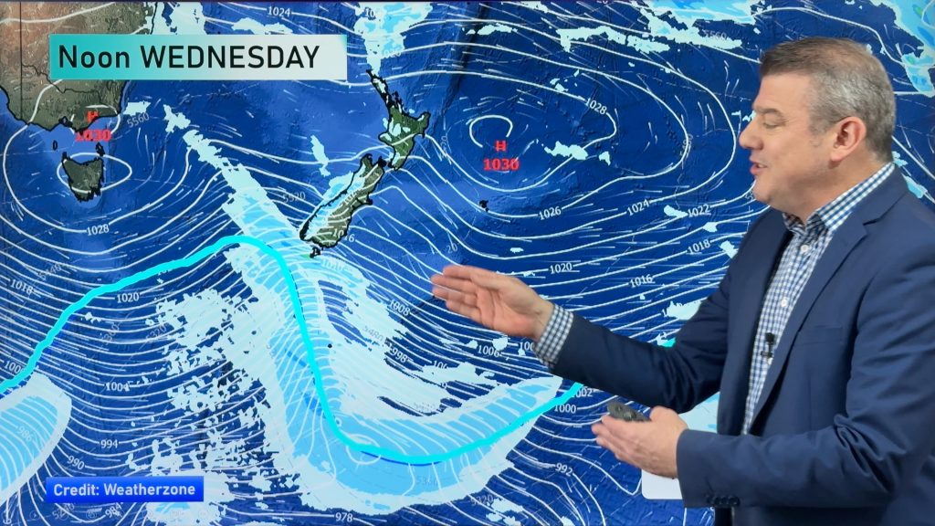
WeatherWatch.co.nz says a significant burst of wet weather will be coming out of tropical Australia within the next week with a low growing in the Tasman Sea this weekend. However blocking high pressure to New Zealand’s east may well limit this wet weather for the North Island – keeping those rainfall totals down. It’s a frustratingly close set up – and there is still some wiggle room to allow for greater rainfall totals. In saying that, the highs have been dominating NZ’s weather all year so it would be a significant surprise to see that suddenly change this weekend.

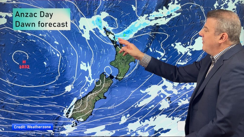
When we take a look at June 1st and the air pressure set up it’s again obvious high pressure is bigger and more dominant in the New Zealand / Tasman / Australia region. A low forming in SE Aussie may be worth monitoring in the first week of June but high pressure looks fairly dominant over the NZ area.


www.RuralWeather.co.nz – The world’s largest weather data website for your local part of New Zealand!
Comments
Before you add a new comment, take note this story was published on 18 May 2020.


Add new comment
Peter on 18/05/2020 11:42pm
If we get that 20 mils in may it will still be the wettest month this year if WE GET IT
Reply
Phil Clements on 18/05/2020 11:00pm
Hi Weatherwatch.
I’ve been watching with interest over the last year or more now the large bands of high pressure that are rolling across from Western Australia right through New Zealand and beyond. It appears the high pressure systems are virtually joining up creating one long never ending “sausage” of high pressure.
My question is not “how” they are formed, but “why” they are formed. There is a very definite change in the prevailing weather patterns: -why is that? – and with knowledge from the previous 12 months would we now expect the next 12 months – or perhaps a perminant shift – to the same weather pattern?
It would be facinating to have a scientific insight.
Reply
WW Forecast Team on 19/05/2020 5:07am
Hi Phil C, I’m not too sure why we seem to be getting a fairly consistent belt of high pressure. You get the feeling the air or oecan has warmed or cooled somewhere in such a way the Southern Hemisphere high pressure boundaries have shifted a little. In New Zealand neither Niwa or MetService have made it clear what is leading to this stream of high pressure. They both have opposing forecasts now they are more commercial than public – and they have had significant mistakes in seasonal outlooks over the past 12 months. We never got the storms Niwa warned of after the sudden stratospheric warming over Antarctica last spring and we haven’t had the wet and stormy May that MetService was forecasting. If the pattern doesn’t shake itself this year many parts of New Zealand may start to mirror more of a New South Wales weather pattern. I feel it will break up at some point – nature has a way of balancing itself in this country…if that is the case we may go from very dry to very wet, but for now it’s a continuation of this pattern into June. Sorry I can’t explain it further. I’m also not a scientist so I suggest approaching Niwa and MetService and asking for their thoughts too. 🙂
Cheers
Phil D
Reply
Phil Clements on 19/05/2020 10:55pm
Thanks Phil D, much appreciate your comments. Observationally, I first noticed the bands of high pressure during the summer of 2019. They have continued right through until now except for a break in August / September 2019 which were consistantly damp months (although not high rainfall) – for Northern NZ anyway. It will be interestng to see if this pattern reoccurs this year – and perhaps signalling a “wet season” of sorts for northern NZ ?
Reply
Dawn on 18/05/2020 8:22pm
Thank you for your comprehensive weather update. Really appreciate the arrows between the map and the rainfall scale. Sometimes it’s not easy to tell which area on the scale, the colour on the map, relates to. Thanks again.
Reply