Drier weather returning, warmer too + some tropical trouble brewing
3/12/2025 11:31pm
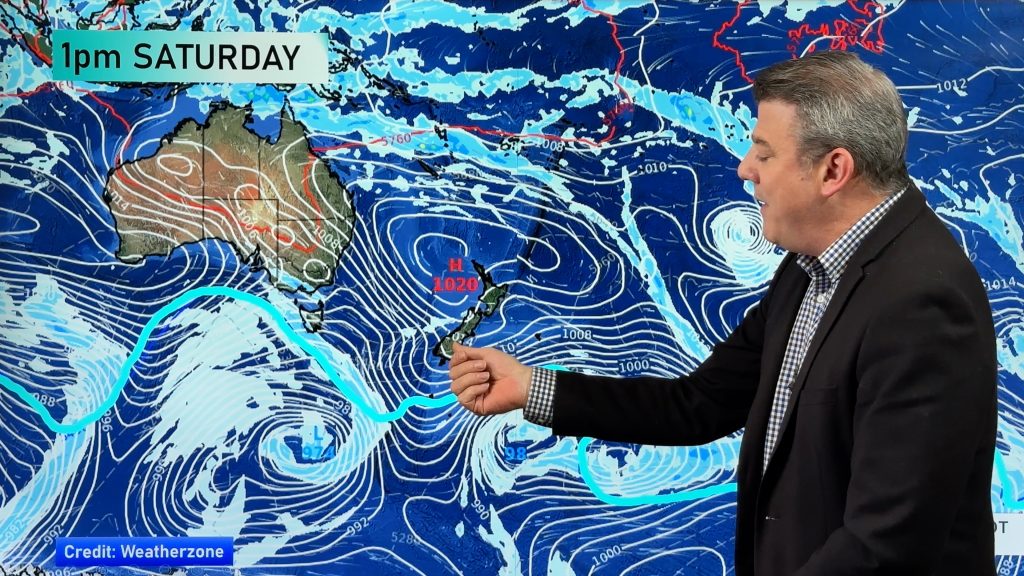
High pressure is moving closer to NZ today, pushing away yesterday’s downpours and thunderstorms well offshore east of the country, but a windier airflow today continues around the North Island and central NZ.
In the days ahead west to north-west winds will pick up again, lifting temperatures especially in the east.
Meanwhile late next week well north of NZ around the Solomon Islands and Vanuatu we may see our first South-West Pacific tropical cyclone – although at this early stage it can’t be locked in, but we talk about where it may form.
+ we have NZ’s 7 Day Rainfall map.
Latest Video

Polar airflows set to bring cold weekend to NZ
Nor-west winds will be building over parts of NZ going into Thursday with rain on the West Coast becoming heavy…
Related Articles

Wind, rain, showers & a noticeable temperature drop for all
It will be a colder weekend right across NZ as a sub-Antarctic southerly blows through, bringing frosts, snow flurries and…
Polar airflows set to bring cold weekend to NZ
Nor-west winds will be building over parts of NZ going into Thursday with rain on the West Coast becoming heavy…

Update on incoming cold change for NZ
High pressure still covers NZ but that will slide offshore as we go into Friday and the weekend as a…

